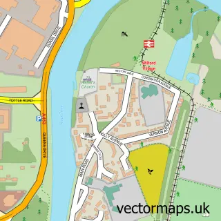
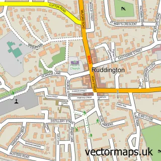
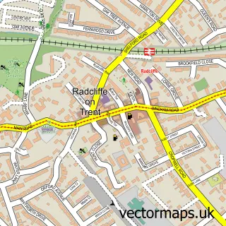
This West Bridgford street map is a detailed vector street map covering a 750m x 750m area. Select a larger area to create and download your own vector street map of West Bridgford.
The 750-metre map sample for West Bridgford covers 550 mapped buildings and approximately 31.3 km of road detail, of which 36 named roads are named. The immediate area includes 12 GP surgeries within 2 miles, 5 pubs and 1 MOT station, with 33 within 2 miles. The wider area around West Bridgford features 5 tourism points of interest, 18 food and drink venues and 1 campsite within 2 miles. To create a larger or custom map of West Bridgford, the map builder lets you define your own coverage area and download editable SVG, PDF and PNG files.
Create a larger editable map of West Bridgford
Choose any area you need and generate a high-quality vector map instantly. Perfect for print, planning, design, business and personal use.

This West Bridgford street map in Nottinghamshire is available as downloadable SVG, PDF and PNG map files, or as a printed map for planning, business, display, education, local information and design work. You can also create a larger custom map area using the map selector.
What this West Bridgford map sample shows
West Bridgford lies within Nottinghamshire County parish, part of Lutterell ward in the Rushcliffe District (B) local authority area. The postcode geography for this area includes the NG postcode area, the NG2 postcode district and the NG2 7 postcode sector. Residents fall under the Nhs Nottingham And Nottinghamshire Integrated Care Board for NHS services.
Local features near West Bridgford
Within 2 milesAmenities and services in and around West Bridgford.
Administrative and postcode information for West Bridgford
West Bridgford lies within Nottinghamshire County parish, part of Lutterell ward in the Rushcliffe District (B) local authority area. The postcode geography for this area includes the NG postcode area, the NG2 postcode district and the NG2 7 postcode sector. Residents fall under the Nhs Nottingham And Nottinghamshire Integrated Care Board for NHS services.
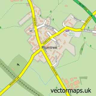
Nearby street map samples around West Bridgford

More street maps in Nottinghamshire
750 metre map area coverage
Boundary, postcode and point of interest information for the 750m x 750m rectangle centred on this sample map.
Boundaries containing map centre
Constituency: Rushcliffe Co Const
County: Nottinghamshire County
District: Rushcliffe District (B)
Icb: NHS Nottingham and Nottinghamshire ICB
Police Force: nottinghamshire
Postcode District: NG2
Postcode Sector: NG2 6
Ward: Abbey Ward
Nearby boundaries intersecting sample
Postcode Sector: NG2 5, NG2 7
Ward: Lady Bay Ward, Musters Ward, Trent Bridge Ward
Postcode coverage
POI category counts
Hair Salon: 15
Beauty Salon: 11
Real Estate Agent: 11
Accountant: 9
Advertising Agency: 9
Retail: 9
Financial Service: 8
Cafe: 7
Dentist: 7
Gym: 7
Sample points of interest
- 9Ine Accounting
- 9Ine Chartered Accountants
- Alexanders
- Ashbys Accountants
- Bexons Accountants
- Bob Stevens Management
- Collins Chapple & Co. Ltd.
- Lodder & Co.
- Vanilla Accounting
- Lisa Gordon Acupuncture
- Lisa Gordon Acupuncture
- Blimey Creative
Create a larger editable map of West Bridgford
This sample shows only a 750 metre area. To create a larger map of West Bridgford, use our map builder to choose your own coverage area, add titles and download editable SVG, PDF and PNG files.
Create a custom map of West Bridgford