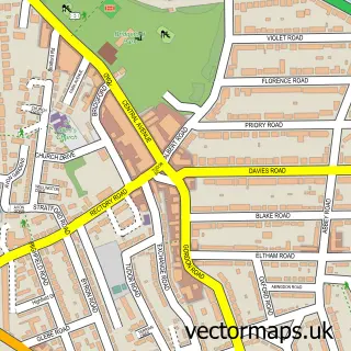
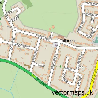
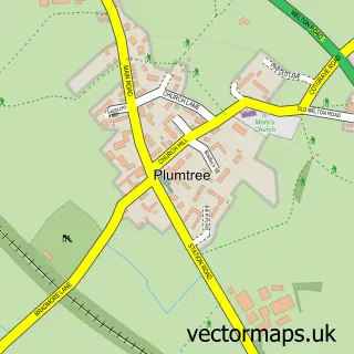
This Wilford street map is a detailed vector street map covering a 750m x 750m area. Select a larger area to create and download your own vector street map of Wilford.
The 750-metre map sample for Wilford covers 129 mapped buildings and approximately 12.5 km of road detail, of which 15 named roads are named. The immediate area includes 2 schools, 1 railway station, 15 GP surgeries within 2 miles and 4 pubs among other local services. The wider area around Wilford features 4 food and drink venues and 2 hotels. To create a larger or custom map of Wilford, the map builder lets you define your own coverage area and download editable SVG, PDF and PNG files.
Create a larger editable map of Wilford
Choose any area you need and generate a high-quality vector map instantly. Perfect for print, planning, design, business and personal use.

This Wilford street map in Nottinghamshire is available as downloadable SVG, PDF and PNG map files, or as a printed map for planning, business, display, education, local information and design work. You can also create a larger custom map area using the map selector.
What this Wilford map sample shows
Wilford lies within City Of Nottingham (B) parish, part of Clifton West ward in the City Of Nottingham (B) local authority area. The postcode geography for this area includes the NG postcode area, the NG11 postcode district and the NG11 7 postcode sector. Residents fall under the Nhs Nottingham And Nottinghamshire Integrated Care Board for NHS services.
Local features near Wilford
Within 2 milesAmenities and services in and around Wilford.
Administrative and postcode information for Wilford
Wilford lies within City Of Nottingham (B) parish, part of Clifton West ward in the City Of Nottingham (B) local authority area. The postcode geography for this area includes the NG postcode area, the NG11 postcode district and the NG11 7 postcode sector. Residents fall under the Nhs Nottingham And Nottinghamshire Integrated Care Board for NHS services.
Nearby street map samples around Wilford

More street maps in Nottinghamshire
750 metre map area coverage
Boundary, postcode and point of interest information for the 750m x 750m rectangle centred on this sample map.
Boundaries containing map centre
Constituency: Nottingham South Boro Const
District: City of Nottingham (B)
Icb: NHS Nottingham and Nottinghamshire ICB
Police Force: nottinghamshire
Postcode District: NG11
Postcode Sector: NG11 7
Ward: Clifton West Ward
Nearby boundaries intersecting sample
Constituency: Rushcliffe Co Const
County: Nottinghamshire County
District: Rushcliffe District (B)
Postcode District: NG2
Postcode Sector: NG2 1, NG2 2, NG2 7
Ward: Compton Acres Ward, Meadows Ward
Postcode coverage
POI category counts
Pub: 4
Elementary School: 3
Car Dealer: 2
Church Cathedral: 2
Hotel: 2
Scout Hall: 2
Sports And Recreation Venue: 2
Active Life: 1
Automotive: 1
Bookstore: 1
Sample points of interest
- Moderns Rugby Football Club
- Marshall London Electric Vehicle Company (LEVC) Nottingham
- Books About You
- AP Joinery & Refurbishments Ltd
- FedEx Station
- Marshall Volvo
- Porsche Centre Nottingham
- AP Renovations Group
- Wilford Church Halls
- Saint Wilfrid's Church, Nottingham
- St Wilfrid's
- South Wilford Primary School
Create a larger editable map of Wilford
This sample shows only a 750 metre area. To create a larger map of Wilford, use our map builder to choose your own coverage area, add titles and download editable SVG, PDF and PNG files.
Create a custom map of Wilford