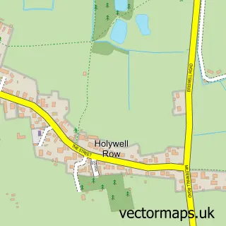
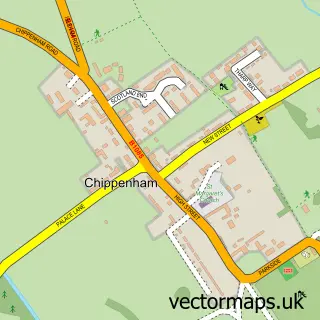
This West Row street map is a detailed vector street map covering a 750m x 750m area. Select a larger area to create and download your own vector street map of West Row.
The 750-metre map sample for West Row covers 235 mapped buildings and approximately 8.6 km of road detail, of which 15 named roads are named. The immediate area includes 2 MOT stations within 2 miles. The wider area around West Row features 2 campsites within 2 miles. To create a larger or custom map of West Row, the map builder lets you define your own coverage area and download editable SVG, PDF and PNG files.
Create a larger editable map of West Row
Choose any area you need and generate a high-quality vector map instantly. Perfect for print, planning, design, business and personal use.

This West Row street map in Suffolk is available as downloadable SVG, PDF and PNG map files, or as a printed map for planning, business, display, education, local information and design work. You can also create a larger custom map area using the map selector.
What this West Row map sample shows
West Row lies within West Row Cp parish, part of The Rows ward in the West Suffolk District local authority area. The postcode geography for this area includes the IP postcode area, the IP28 postcode district and the IP28 8 postcode sector. Residents fall under the Nhs Suffolk And North East Essex Integrated Care Board for NHS services.
Local features near West Row
Within 2 milesAmenities and services in and around West Row.
Administrative and postcode information for West Row
West Row lies within West Row Cp parish, part of The Rows ward in the West Suffolk District local authority area. The postcode geography for this area includes the IP postcode area, the IP28 postcode district and the IP28 8 postcode sector. Residents fall under the Nhs Suffolk And North East Essex Integrated Care Board for NHS services.
Nearby street map samples around West Row

More street maps in Suffolk
750 metre map area coverage
Boundary, postcode and point of interest information for the 750m x 750m rectangle centred on this sample map.
Boundaries containing map centre
Constituency: West Suffolk Co Const
County: Suffolk County
District: West Suffolk District
Icb: NHS Essex ICB
Parish: West Row CP
Police Force: suffolk
Postcode District: IP28
Postcode Sector: IP28 8
Ward: The Rows Ward
Nearby boundaries intersecting sample
No additional intersecting boundaries found.
Postcode coverage
POI category counts
Electrician: 3
It Service And Computer Repair: 2
Anglican Church: 1
Baptist Church: 1
Beauty Salon: 1
Church Cathedral: 1
Community Center: 1
Custom T Shirt Store: 1
Holiday Rental Home: 1
Hvac Services: 1
Sample points of interest
- West Row, St Peter
- West Row Baptist Church
- Serenity Beauty
- St. Peter's Church
- West Row Village Hall
- 1 Ormore Designs Ltd.
- A B Electrical
- B a Electrical Contractors
- GBA Electrical
- The Walnuts B&B
- Heatmaster UK
- Budget Computers
Create a larger editable map of West Row
This sample shows only a 750 metre area. To create a larger map of West Row, use our map builder to choose your own coverage area, add titles and download editable SVG, PDF and PNG files.
Create a custom map of West Row