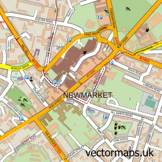
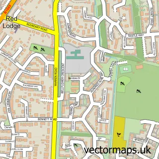
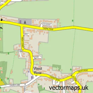
This Chippenham street map is a detailed vector street map covering a 750m x 750m area. Select a larger area to create and download your own vector street map of Chippenham.
The 750-metre map sample for Chippenham covers 181 mapped buildings and approximately 13.7 km of road detail, of which 9 named roads are named. The immediate area includes 2 pubs and 1 MOT station within 2 miles. The wider area around Chippenham features 3 food and drink venues. To create a larger or custom map of Chippenham, the map builder lets you define your own coverage area and download editable SVG, PDF and PNG files.
Create a larger editable map of Chippenham
Choose any area you need and generate a high-quality vector map instantly. Perfect for print, planning, design, business and personal use.

This Chippenham street map in Cambridgeshire is available as downloadable SVG, PDF and PNG map files, or as a printed map for planning, business, display, education, local information and design work. You can also create a larger custom map area using the map selector.
What this Chippenham map sample shows
Chippenham lies within Chippenham Cp parish, part of Fordham & Isleham ward in the East Cambridgeshire District local authority area. The postcode geography for this area includes the CB postcode area, the CB7 postcode district and the CB7 5 postcode sector. Residents fall under the Nhs Cambridgeshire And Peterborough Integrated Care Board for NHS services.
Local features near Chippenham
Within 2 milesAmenities and services in and around Chippenham.
Administrative and postcode information for Chippenham
Chippenham lies within Chippenham Cp parish, part of Fordham & Isleham ward in the East Cambridgeshire District local authority area. The postcode geography for this area includes the CB postcode area, the CB7 postcode district and the CB7 5 postcode sector. Residents fall under the Nhs Cambridgeshire And Peterborough Integrated Care Board for NHS services.
Nearby street map samples around Chippenham

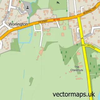
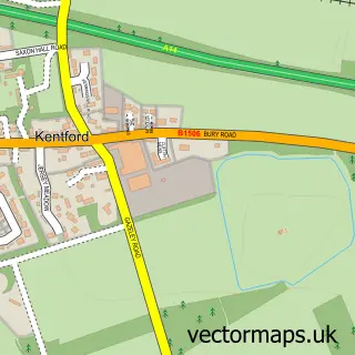
More street maps in Cambridgeshire
750 metre map area coverage
Boundary, postcode and point of interest information for the 750m x 750m rectangle centred on this sample map.
Boundaries containing map centre
Constituency: Ely and East Cambridgeshire Co Const
County: Cambridgeshire County
District: East Cambridgeshire District
Icb: NHS Central East ICB
Parish: Chippenham CP
Police Force: cambridgeshire
Postcode District: CB7
Postcode Sector: CB7 5
Ward: Fordham & Isleham Ward
Nearby boundaries intersecting sample
No additional intersecting boundaries found.
Postcode coverage
POI category counts
Church Cathedral: 2
Pub: 2
Anglican Church: 1
Beauty Product Supplier: 1
Business Consulting: 1
Contractor: 1
Photography Store And Services: 1
Playground: 1
Professional Services: 1
Restaurant: 1
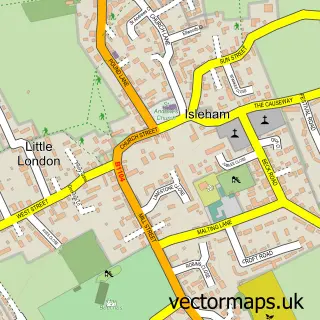
Sample points of interest
- St Margaret of Antioch Chippenham
- Aloe Health
- Munro Consulting
- Isleham Parish Church St. Andrew
- Three Rivers Churches
- GJS Plastering
- At Photography
- Chippenham Play Park
- Peter Denness
- Tharp Arms
- The Tharp Arms
- The Green King
Create a larger editable map of Chippenham
This sample shows only a 750 metre area. To create a larger map of Chippenham, use our map builder to choose your own coverage area, add titles and download editable SVG, PDF and PNG files.
Create a custom map of Chippenham