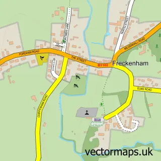
This Barton Mills street map is a detailed vector street map covering a 750m x 750m area. Select a larger area to create and download your own vector street map of Barton Mills.
The 750-metre map sample for Barton Mills covers 225 mapped buildings and approximately 13.5 km of road detail, of which 12 named roads are named. The immediate area includes 1 GP surgery within 2 miles, 1 pub and 8 MOT stations within 2 miles. The wider area around Barton Mills features 1 tourism point of interest and 1 food and drink venue. To create a larger or custom map of Barton Mills, the map builder lets you define your own coverage area and download editable SVG, PDF and PNG files.
Create a larger editable map of Barton Mills
Choose any area you need and generate a high-quality vector map instantly. Perfect for print, planning, design, business and personal use.

This Barton Mills street map in Suffolk is available as downloadable SVG, PDF and PNG map files, or as a printed map for planning, business, display, education, local information and design work. You can also create a larger custom map area using the map selector.
What this Barton Mills map sample shows
Barton Mills lies within Barton Mills Cp parish, part of Manor ward in the West Suffolk District local authority area. The postcode geography for this area includes the IP postcode area, the IP28 postcode district and the IP28 6 postcode sector. Residents fall under the Nhs Suffolk And North East Essex Integrated Care Board for NHS services.
Local features near Barton Mills
Within 2 milesAmenities and services in and around Barton Mills.
Administrative and postcode information for Barton Mills
Barton Mills lies within Barton Mills Cp parish, part of Manor ward in the West Suffolk District local authority area. The postcode geography for this area includes the IP postcode area, the IP28 postcode district and the IP28 6 postcode sector. Residents fall under the Nhs Suffolk And North East Essex Integrated Care Board for NHS services.
Nearby street map samples around Barton Mills

More street maps in Suffolk
750 metre map area coverage
Boundary, postcode and point of interest information for the 750m x 750m rectangle centred on this sample map.
Boundaries containing map centre
Constituency: West Suffolk Co Const
County: Suffolk County
District: West Suffolk District
Icb: NHS Essex ICB
Parish: Barton Mills CP
Police Force: suffolk
Postcode District: IP28
Postcode Sector: IP28 6
Ward: Manor Ward
Nearby boundaries intersecting sample
No additional intersecting boundaries found.
Postcode coverage
POI category counts
Beauty And Spa: 2
Driving School: 2
Advertising Agency: 1
Anglican Church: 1
Bar: 1
Contractor: 1
Cottage: 1
General Dentistry: 1
International Business And Trade Services: 1
Korean Grocery Store: 1
Sample points of interest
- H Signs
- Barton Mills, St Mary the Virgin
- Bell Inn
- Brows Nails Lashes Okinawa
- The Good Part
- Harlows heating
- Appletree Cottages
- Drivewise
- Pembroke Driving Academy
- The Manor Orthodontic Practice
- Cliff Hinchley Garage Door Repairs
- The Big Red Wine Company
Create a larger editable map of Barton Mills
This sample shows only a 750 metre area. To create a larger map of Barton Mills, use our map builder to choose your own coverage area, add titles and download editable SVG, PDF and PNG files.
Create a custom map of Barton Mills