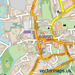
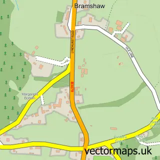
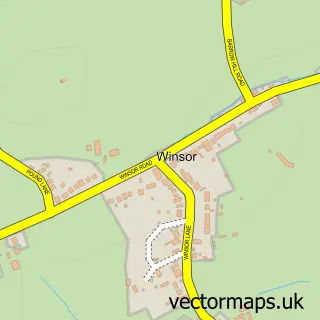
This West Wellow street map is a detailed vector street map covering a 750m x 750m area. Select a larger area to create and download your own vector street map of West Wellow.
The 750-metre map sample for West Wellow covers 412 mapped buildings and approximately 12.4 km of road detail, of which 20 named roads are named. The immediate area includes 2 pubs and 1 MOT station, with 5 within 2 miles. The wider area around West Wellow features 1 tourism point of interest, 2 food and drink venues and 2 campsites within 2 miles. To create a larger or custom map of West Wellow, the map builder lets you define your own coverage area and download editable SVG, PDF and PNG files.
Create a larger editable map of West Wellow
Choose any area you need and generate a high-quality vector map instantly. Perfect for print, planning, design, business and personal use.

This West Wellow street map in Hampshire is available as downloadable SVG, PDF and PNG map files, or as a printed map for planning, business, display, education, local information and design work. You can also create a larger custom map area using the map selector.
What this West Wellow map sample shows
West Wellow lies within Wellow Cp parish, part of Blackwater ward in the Test Valley District local authority area. The postcode geography for this area includes the SO postcode area, the SO51 postcode district and the SO51 6 postcode sector. Residents fall under the Nhs Hampshire And Isle Of Wight Integrated Care Board for NHS services.
Local features near West Wellow
Within 2 milesAmenities and services in and around West Wellow.
Administrative and postcode information for West Wellow
The local authority covering West Wellow is Test Valley District, within the county of Hampshire. The settlement lies within Blackwater ward and Wellow Cp civil parish. The SO51 postcode district and SO51 6 postcode sector serve the immediate area. NHS provision in the area is delivered through University Hospital Southampton Nhs Foundation Trust.
Nearby street map samples around West Wellow

More street maps in Hampshire
750 metre map area coverage
Boundary, postcode and point of interest information for the 750m x 750m rectangle centred on this sample map.
Boundaries containing map centre
Constituency: Romsey and Southampton North Co Const
County: Hampshire County
District: Test Valley District
Icb: NHS Hampshire and Isle of Wight ICB
Parish: Wellow CP
Police Force: hampshire
Postcode District: SO51
Postcode Sector: SO51 6
Ward: Blackwater Ward
Nearby boundaries intersecting sample
Parish: Melchet Park and Plaitford CP
Postcode coverage
POI category counts
Butcher Shop: 2
Counseling And Mental Health: 2
Package Locker: 2
Pub: 2
Beauty Salon: 1
Building Supply Store: 1
Church Cathedral: 1
Contractor: 1
Courier And Delivery Services: 1
Food Delivery Service: 1
Sample points of interest
- Ayano Spa
- Constant Pest Control Services
- Mike's New Forest Butchers
- New Forest Family Butchers
- Cadnam Methodist Church
- James Golby Construction
- Willow Tree Therapeutic Agency
- Willow Tree Therapeutic Agency
- Evri ParcelShop
- Evri ParcelShop
- Hair Review
- Country Consumables
Create a larger editable map of West Wellow
This sample shows only a 750 metre area. To create a larger map of West Wellow, use our map builder to choose your own coverage area, add titles and download editable SVG, PDF and PNG files.
Create a custom map of West Wellow