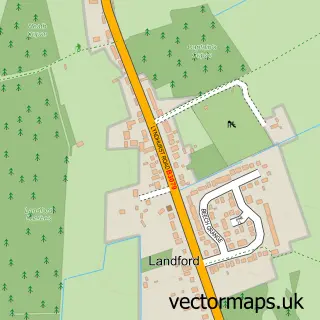
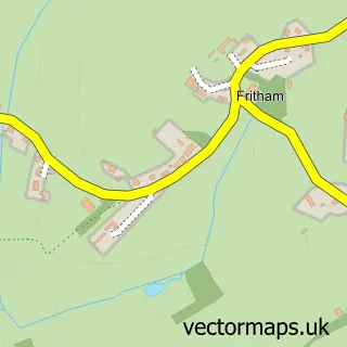
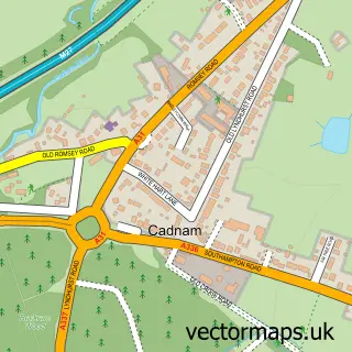
This Nomansland street map is a detailed vector street map covering a 750m x 750m area. Select a larger area to create and download your own vector street map of Nomansland.
The 750-metre map sample for Nomansland covers 230 mapped buildings and approximately 11.2 km of road detail, of which 6 named roads are named. The immediate area includes 1 school, 1 pub and 1 MOT station, with 4 within 2 miles. The wider area around Nomansland features 5 tourism points of interest, 1 food and drink venue and 1 campsite within 2 miles. To create a larger or custom map of Nomansland, the map builder lets you define your own coverage area and download editable SVG, PDF and PNG files.
Create a larger editable map of Nomansland
Choose any area you need and generate a high-quality vector map instantly. Perfect for print, planning, design, business and personal use.

This Nomansland street map in Wiltshire is available as downloadable SVG, PDF and PNG map files, or as a printed map for planning, business, display, education, local information and design work. You can also create a larger custom map area using the map selector.
What this Nomansland map sample shows
Nomansland lies within Bramshaw Cp parish, part of Bramshaw, Copythorne North And Minstead ward in the New Forest District local authority area. The postcode geography for this area includes the SP postcode area, the SP5 postcode district and the SP5 2 postcode sector. Residents fall under the Nhs Hampshire And Isle Of Wight Integrated Care Board for NHS services.
Local features near Nomansland
Within 2 milesAmenities and services in and around Nomansland.
Administrative and postcode information for Nomansland
The local authority covering Nomansland is New Forest District, within the county of Wiltshire. The settlement lies within Bramshaw, Copythorne North And Minstead ward and Bramshaw Cp civil parish. The SP5 postcode district and SP5 2 postcode sector serve the immediate area. NHS provision in the area is delivered through University Hospital Southampton Nhs Foundation Trust.
Nearby street map samples around Nomansland
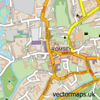

More street maps in Wiltshire
750 metre map area coverage
Boundary, postcode and point of interest information for the 750m x 750m rectangle centred on this sample map.
Boundaries containing map centre
Constituency: Salisbury Co Const
District: Wiltshire
Icb: NHS Bath and North East Somerset Swindon and Wiltshire ICB
Parish: Landford CP
Police Force: wiltshire
Postcode District: SP5
Postcode Sector: SP5 2
Nearby boundaries intersecting sample
Constituency: New Forest East Co Const
County: Hampshire County
District: New Forest District
Icb: NHS Hampshire and Isle of Wight ICB
Parish: Bramshaw CP
Police Force: hampshire
Ward: Ashurst, Bramshaw, Copythorne & Netley Marsh Ward
Postcode coverage
POI category counts
Campground: 2
Park: 2
Automotive Repair: 1
Building Supply Store: 1
Community Center: 1
Dentist: 1
Elementary School: 1
French Restaurant: 1
Health And Medical: 1
Landmark And Historical Building: 1
Sample points of interest
- Nomansland Garage Ltd
- Pro-Build
- Carron Campsite
- Tanglewood Field Camping
- Nomansland Reading Room
- New Forest Implant Office
- Nomansland & Hamptworth C of E Primary School
- Les Mirabelles
- Veiné Cosmetic Healthcare
- Nomansland New Forest Hampshire
- Bolderwood Deer Sanctuary
- Pipers Wait New Forest
Create a larger editable map of Nomansland
This sample shows only a 750 metre area. To create a larger map of Nomansland, use our map builder to choose your own coverage area, add titles and download editable SVG, PDF and PNG files.
Create a custom map of Nomansland