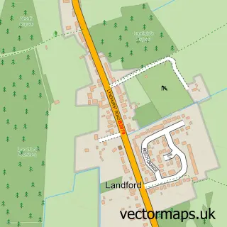
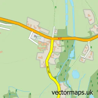
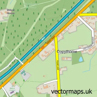
This Plaitford street map is a detailed vector street map covering a 750m x 750m area. Select a larger area to create and download your own vector street map of Plaitford.
The 750-metre map sample for Plaitford covers 160 mapped buildings and approximately 4.5 km of road detail, of which 5 named roads are named. The immediate area includes 1 pub and 1 MOT station, with 6 within 2 miles. The wider area around Plaitford features 2 food and drink venues and 2 campsites within 2 miles. To create a larger or custom map of Plaitford, the map builder lets you define your own coverage area and download editable SVG, PDF and PNG files.
Create a larger editable map of Plaitford
Choose any area you need and generate a high-quality vector map instantly. Perfect for print, planning, design, business and personal use.

This Plaitford street map in Wiltshire is available as downloadable SVG, PDF and PNG map files, or as a printed map for planning, business, display, education, local information and design work. You can also create a larger custom map area using the map selector.
What this Plaitford map sample shows
Plaitford lies within Landford Cp parish, part of Redlynch And Landford ward in the Wiltshire local authority area. The postcode geography for this area includes the SP postcode area, the SP5 postcode district and the SP5 2 postcode sector. Residents fall under the Nhs Bath And North East Somerset, Swindon And Wiltshire Integrated Care Board for NHS services.
Local features near Plaitford
Within 2 milesAmenities and services in and around Plaitford.
Administrative and postcode information for Plaitford
Plaitford lies within Landford Cp parish, part of Redlynch And Landford ward in the Wiltshire local authority area. The postcode geography for this area includes the SP postcode area, the SP5 postcode district and the SP5 2 postcode sector. Residents fall under the Nhs Bath And North East Somerset, Swindon And Wiltshire Integrated Care Board for NHS services.
Nearby street map samples around Plaitford

More street maps in Wiltshire
750 metre map area coverage
Boundary, postcode and point of interest information for the 750m x 750m rectangle centred on this sample map.
Boundaries containing map centre
Constituency: Salisbury Co Const
District: Wiltshire
Icb: NHS Hampshire and Isle of Wight ICB
Parish: Landford CP
Police Force: hampshire, wiltshire
Postcode District: SP5
Postcode Sector: SP5 2
Nearby boundaries intersecting sample
Constituency: Romsey and Southampton North Co Const
County: Hampshire County
District: Test Valley District
Icb: NHS Bath and North East Somerset Swindon and Wiltshire ICB
Parish: Melchet Park and Plaitford CP
Postcode District: SO51
Postcode Sector: SO51 6
Ward: Blackwater Ward
Postcode coverage
POI category counts
Gas Station: 3
Cheese Shop: 2
Used Car Dealer: 2
Architectural Designer: 1
Arts And Crafts: 1
Automotive Repair: 1
Bed And Breakfast: 1
Carpet Store: 1
Coffee Shop: 1
Contractor: 1
Sample points of interest
- Landford Architectural Services
- Sarah's Stamp Shack
- Landford Garage
- Pyesmead Farm
- Crusader Carpets
- Rosary Goats Cheese
- Rosary Goats Cheese
- Costa Express
- Kitchens & Beyond
- Londis Landford Service Station
- Pye's Holiday Cottages
- BP
Create a larger editable map of Plaitford
This sample shows only a 750 metre area. To create a larger map of Plaitford, use our map builder to choose your own coverage area, add titles and download editable SVG, PDF and PNG files.
Create a custom map of Plaitford