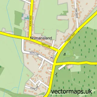
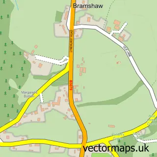
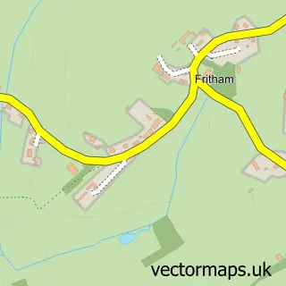
This Landford street map is a detailed vector street map covering a 750m x 750m area. Select a larger area to create and download your own vector street map of Landford.
The 750-metre map sample for Landford covers 156 mapped buildings and approximately 4.2 km of road detail, of which 3 named roads are named. The immediate area includes 5 MOT stations within 2 miles. The wider area around Landford features 1 tourism point of interest and 1 campsite within 2 miles. To create a larger or custom map of Landford, the map builder lets you define your own coverage area and download editable SVG, PDF and PNG files.
Create a larger editable map of Landford
Choose any area you need and generate a high-quality vector map instantly. Perfect for print, planning, design, business and personal use.

This Landford street map in Wiltshire is available as downloadable SVG, PDF and PNG map files, or as a printed map for planning, business, display, education, local information and design work. You can also create a larger custom map area using the map selector.
What this Landford map sample shows
Landford lies within Landford Cp parish, part of Redlynch And Landford ward in the Wiltshire local authority area. The postcode geography for this area includes the SP postcode area, the SP5 postcode district and the SP5 2 postcode sector. Residents fall under the Nhs Bath And North East Somerset, Swindon And Wiltshire Integrated Care Board for NHS services.
Local features near Landford
Within 2 milesAmenities and services in and around Landford.
Administrative and postcode information for Landford
The local authority covering Landford is Wiltshire, within the county of Wiltshire. The settlement lies within Redlynch And Landford ward and Landford Cp civil parish. The SP5 postcode district and SP5 2 postcode sector serve the immediate area. NHS provision in the area is delivered through Salisbury Nhs Foundation Trust.
Nearby street map samples around Landford

More street maps in Wiltshire
750 metre map area coverage
Boundary, postcode and point of interest information for the 750m x 750m rectangle centred on this sample map.
Boundaries containing map centre
Constituency: Salisbury Co Const
District: Wiltshire
Icb: NHS Bath and North East Somerset Swindon and Wiltshire ICB
Parish: Landford CP
Police Force: wiltshire
Postcode District: SP5
Postcode Sector: SP5 2
Nearby boundaries intersecting sample
No additional intersecting boundaries found.
Postcode coverage
POI category counts
Building Supply Store: 1
Business: 1
Dog Walkers: 1
Jewelry Store: 1
Paintball: 1
Park: 1
Pest Control Service: 1
Post Office: 1
Professional Services: 1
Sample points of interest
- Martin & Goddard
- Wareham & Purbeck Skip Hire
- Petmaids
- Moment In Time Jewellery
- Go Ballistic Southampton
- Lyburn Growers
- High & Low Pest Control
- Landford Stores and Post Office
- Eccles Barfield
Create a larger editable map of Landford
This sample shows only a 750 metre area. To create a larger map of Landford, use our map builder to choose your own coverage area, add titles and download editable SVG, PDF and PNG files.
Create a custom map of Landford