This Weston street map is a detailed vector street map covering a 750m x 750m area. Select a larger area to create and download your own vector street map of Weston.
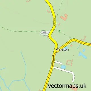
The 750-metre map sample for Weston covers 203 mapped buildings and approximately 10.6 km of road detail, of which 15 named roads are named. The immediate area includes 1 school, 1 pub and 1 MOT station within 2 miles. The wider area around Weston features 2 tourism points of interest and 1 food and drink venue. To create a larger or custom map of Weston, the map builder lets you define your own coverage area and download editable SVG, PDF and PNG files.
Create a larger editable map of Weston
Choose any area you need and generate a high-quality vector map instantly. Perfect for print, planning, design, business and personal use.

This Weston street map in Staffordshire is available as downloadable SVG, PDF and PNG map files, or as a printed map for planning, business, display, education, local information and design work. You can also create a larger custom map area using the map selector.
What this Weston map sample shows
Weston lies within Weston Cp parish, part of Milwich ward in the Stafford District (B) local authority area. The postcode geography for this area includes the ST postcode area, the ST18 postcode district and the ST18 0 postcode sector. Residents fall under the Nhs Staffordshire And Stoke-On-Trent Integrated Care Board for NHS services.
Local features near Weston
Within 2 milesAmenities and services in and around Weston.
Administrative and postcode information for Weston
Weston lies within Weston Cp parish, part of Milwich ward in the Stafford District (B) local authority area. The postcode geography for this area includes the ST postcode area, the ST18 postcode district and the ST18 0 postcode sector. Residents fall under the Nhs Staffordshire And Stoke-On-Trent Integrated Care Board for NHS services.
Nearby street map samples around Weston

More street maps in Staffordshire
750 metre map area coverage
Boundary, postcode and point of interest information for the 750m x 750m rectangle centred on this sample map.
Boundaries containing map centre
Constituency: Stone, Great Wyrley and Penkridge Co Const
County: Staffordshire County
District: Stafford District (B)
Icb: NHS Staffordshire and Stoke-on-Trent ICB
Parish: Weston CP
Police Force: staffordshire
Postcode District: ST18
Postcode Sector: ST18 0
Ward: Milwich Ward
Nearby boundaries intersecting sample
No additional intersecting boundaries found.
Postcode coverage
POI category counts
Anglican Church: 1
Automotive Repair: 1
Caterer: 1
Childrens Clothing Store: 1
Church Cathedral: 1
Elementary School: 1
Gastropub: 1
Home Cleaning: 1
Landmark And Historical Building: 1
Linen: 1
Sample points of interest
- St. Andrew's Church, Weston upon Trent, part of the Mid-Trent Churches Team
- Bennetts Bongos
- Kemp and Kemp Catering
- O BABY
- St Andrews Church
- St Andrews C of E Primary School
- Saracens Head
- Miss Little Dust
- Weston, Staffordshire
- Ian Dowson Blinds Ltd
- Castle Caravans
- Weston Village Park
Create a larger editable map of Weston
This sample shows only a 750 metre area. To create a larger map of Weston, use our map builder to choose your own coverage area, add titles and download editable SVG, PDF and PNG files.
Create a custom map of Weston