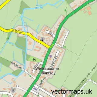
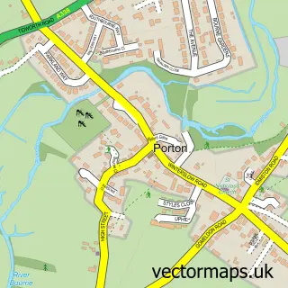
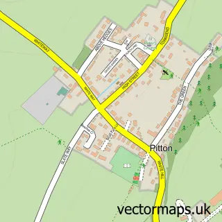
This Winterbourne Earls street map is a detailed vector street map covering a 750m x 750m area. Select a larger area to create and download your own vector street map of Winterbourne Earls.
The 750-metre map sample for Winterbourne Earls covers 142 mapped buildings and approximately 9.7 km of road detail, of which 6 named roads are named. The immediate area includes 1 school and 3 MOT stations within 2 miles. The wider area around Winterbourne Earls features 1 tourism point of interest. To create a larger or custom map of Winterbourne Earls, the map builder lets you define your own coverage area and download editable SVG, PDF and PNG files.
Create a larger editable map of Winterbourne Earls
Choose any area you need and generate a high-quality vector map instantly. Perfect for print, planning, design, business and personal use.

This Winterbourne Earls street map in Wiltshire is available as downloadable SVG, PDF and PNG map files, or as a printed map for planning, business, display, education, local information and design work. You can also create a larger custom map area using the map selector.
What this Winterbourne Earls map sample shows
Winterbourne Earls lies within Winterbourne Cp parish, part of Bourne And Woodford Valley ward in the Wiltshire local authority area. The postcode geography for this area includes the SP postcode area, the SP4 postcode district and the SP4 6 postcode sector. Residents fall under the Nhs Bath And North East Somerset, Swindon And Wiltshire Integrated Care Board for NHS services.
Local features near Winterbourne Earls
Within 2 milesAmenities and services in and around Winterbourne Earls.
Administrative and postcode information for Winterbourne Earls
The local authority covering Winterbourne Earls is Wiltshire, within the county of Wiltshire. The settlement lies within Bourne And Woodford Valley ward and Winterbourne Cp civil parish. The SP4 postcode district and SP4 6 postcode sector serve the immediate area. NHS provision in the area is delivered through Salisbury Nhs Foundation Trust.
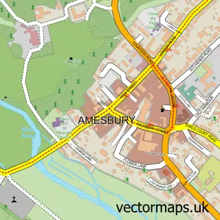
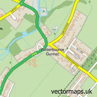
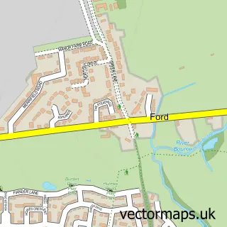
Nearby street map samples around Winterbourne Earls

More street maps in Wiltshire
750 metre map area coverage
Boundary, postcode and point of interest information for the 750m x 750m rectangle centred on this sample map.
Boundaries containing map centre
Constituency: Salisbury Co Const
District: Wiltshire
Icb: NHS Bath and North East Somerset Swindon and Wiltshire ICB
Parish: Winterbourne CP
Police Force: wiltshire
Postcode District: SP4
Postcode Sector: SP4 6
Nearby boundaries intersecting sample
No additional intersecting boundaries found.
Postcode coverage
POI category counts
Web Designer: 2
Anglican Church: 1
Child Care And Day Care: 1
Community Center: 1
Home Service: 1
Landmark And Historical Building: 1
Leather Goods: 1
Pest Control Service: 1
Pet Breeder: 1
Preschool: 1
Sample points of interest
- St Michael & All Angels, Winterbourne Earls with Dauntsey, Hurdcott & Ford
- Bourne Valley Nursery
- The Glebe Hall
- Kindred Winterbourne Earl Day Nursery & Pre-School
- Hurdcott House
- Hurdcott Sadlery & Rug Services
- Killtech Pest Control
- Winterbourne Waterfowl
- Kindred Winterbourne Earl Day Nursery And Pre-School
- Earls Manor Court
- Bourne Valley
- Andy Paddock
Create a larger editable map of Winterbourne Earls
This sample shows only a 750 metre area. To create a larger map of Winterbourne Earls, use our map builder to choose your own coverage area, add titles and download editable SVG, PDF and PNG files.
Create a custom map of Winterbourne Earls