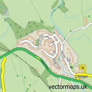
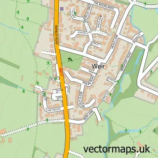
This Worsthorne street map is a detailed vector street map covering a 750m x 750m area. Select a larger area to create and download your own vector street map of Worsthorne.
The 750-metre map sample for Worsthorne covers 208 mapped buildings and approximately 11.6 km of road detail, of which 27 named roads are named. The immediate area includes 1 school, 4 GP surgeries within 2 miles, 2 pubs and 7 MOT stations within 2 miles. The wider area around Worsthorne features 1 tourism point of interest, 3 food and drink venues and 2 hotels. To create a larger or custom map of Worsthorne, the map builder lets you define your own coverage area and download editable SVG, PDF and PNG files.
Create a larger editable map of Worsthorne
Choose any area you need and generate a high-quality vector map instantly. Perfect for print, planning, design, business and personal use.

This Worsthorne street map in Lancashire is available as downloadable SVG, PDF and PNG map files, or as a printed map for planning, business, display, education, local information and design work. You can also create a larger custom map area using the map selector.
What this Worsthorne map sample shows
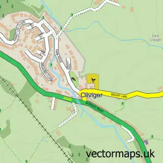
Worsthorne lies within Worsthorne-With-Hurstwood Cp parish, part of Cliviger With Worsthorne ward in the Burnley District (B) local authority area. The postcode geography for this area includes the BB postcode area, the BB10 postcode district and the BB10 3 postcode sector. Residents fall under the Nhs Lancashire And South Cumbria Integrated Care Board for NHS services.
Local features near Worsthorne
Within 2 milesAmenities and services in and around Worsthorne.
Administrative and postcode information for Worsthorne
Worsthorne lies within Worsthorne-With-Hurstwood Cp parish, part of Cliviger With Worsthorne ward in the Burnley District (B) local authority area. The postcode geography for this area includes the BB postcode area, the BB10 postcode district and the BB10 3 postcode sector. Residents fall under the Nhs Lancashire And South Cumbria Integrated Care Board for NHS services.
Nearby street map samples around Worsthorne

More street maps in Lancashire
750 metre map area coverage
Boundary, postcode and point of interest information for the 750m x 750m rectangle centred on this sample map.
Boundaries containing map centre
Constituency: Burnley Co Const
County: Lancashire County
District: Burnley District (B)
Icb: NHS Lancashire and South Cumbria ICB
Parish: Worsthorne-with-Hurstwood CP
Police Force: lancashire
Postcode District: BB10
Postcode Sector: BB10 3
Ward: Cliviger with Worsthorne Ward
Nearby boundaries intersecting sample
No additional intersecting boundaries found.
Postcode coverage
POI category counts
Anglican Church: 2
Hotel: 2
Pub: 2
Accommodation: 1
B2b Textiles: 1
Bar: 1
Beauty Salon: 1
Building Supply Store: 1
Business Consulting: 1
Business Manufacturing And Supply: 1
Sample points of interest
- 21 Ormerod Street
- St John The Evangelist Church
- St John the Evangelist, Worsthorne
- Park Hill Textiles Ltd
- Irvines Bar
- Carly’s Hair and Beauty@Redds
- Worsthorne Skips
- H R Dept
- Carr Reinforcements Ltd
- Sam's
- Worsthorne Church
- The Reading Rooms
Create a larger editable map of Worsthorne
This sample shows only a 750 metre area. To create a larger map of Worsthorne, use our map builder to choose your own coverage area, add titles and download editable SVG, PDF and PNG files.
Create a custom map of Worsthorne