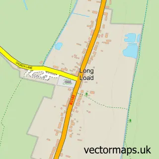
This Ash street map is a detailed vector street map covering a 750m x 750m area. Select a larger area to create and download your own vector street map of Ash.
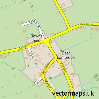
The 750-metre map sample for Ash covers 158 mapped buildings and approximately 8.9 km of road detail, of which 4 named roads are named. The immediate area includes 1 school, 1 GP surgery within 2 miles, 2 pubs and 4 MOT stations within 2 miles. The wider area around Ash features 2 tourism points of interest and 3 food and drink venues. To create a larger or custom map of Ash, the map builder lets you define your own coverage area and download editable SVG, PDF and PNG files.
Create a larger editable map of Ash
Choose any area you need and generate a high-quality vector map instantly. Perfect for print, planning, design, business and personal use.

This Ash street map in Somerset is available as downloadable SVG, PDF and PNG map files, or as a printed map for planning, business, display, education, local information and design work. You can also create a larger custom map area using the map selector.
What this Ash map sample shows
Ash lies within Ash Cp parish, part of Martock ward in the Somerset local authority area. The postcode geography for this area includes the TA postcode area, the TA12 postcode district and the TA12 6 postcode sector. Residents fall under the Nhs Somerset Integrated Care Board for NHS services.
Local features near Ash
Within 2 milesAmenities and services in and around Ash.
Administrative and postcode information for Ash
Ash lies within Ash Cp parish, part of Martock ward in the Somerset local authority area. The postcode geography for this area includes the TA postcode area, the TA12 postcode district and the TA12 6 postcode sector. Residents fall under the Nhs Somerset Integrated Care Board for NHS services.
Nearby street map samples around Ash

More street maps in Somerset
750 metre map area coverage
Boundary, postcode and point of interest information for the 750m x 750m rectangle centred on this sample map.
Boundaries containing map centre
Constituency: Glastonbury and Somerton Co Const
District: Somerset
Icb: NHS Somerset ICB
Parish: Ash CP
Police Force: avon and somerset
Postcode District: TA12
Postcode Sector: TA12 6
Nearby boundaries intersecting sample
Parish: Martock CP
Postcode coverage
POI category counts
Elementary School: 2
Pub: 2
Anglican Church: 1
Attractions And Activities: 1
Building Supply Store: 1
Flooring Contractors: 1
Gift Shop: 1
Home Goods Store: 1
Nature Reserve: 1
Park: 1
Sample points of interest
- Holy Trinity
- Millenium Wood
- Ash Contractors
- Ash C of E Primary School
- Ash CEVC Primary School & Nursery
- Langdon Flooring Concepts
- The Paperweight People
- Willow and Hawthorn
- Ash Millennium Wood
- Ash Village Recreation Ground
- Ash Post Office
- Bell
Create a larger editable map of Ash
This sample shows only a 750 metre area. To create a larger map of Ash, use our map builder to choose your own coverage area, add titles and download editable SVG, PDF and PNG files.
Create a custom map of Ash