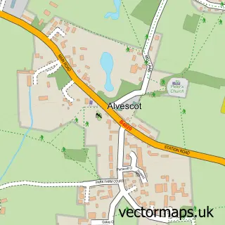
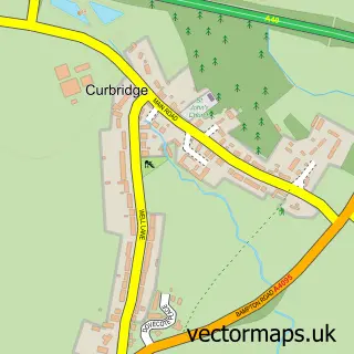
This Bampton street map is a detailed vector street map covering a 750m x 750m area. Select a larger area to create and download your own vector street map of Bampton.
The 750-metre map sample for Bampton covers 326 mapped buildings and approximately 19.3 km of road detail, of which 26 named roads are named. The immediate area includes 1 GP surgery within 2 miles, 4 pubs and 1 MOT station within 2 miles. The wider area around Bampton features 1 tourism point of interest and 5 food and drink venues. To create a larger or custom map of Bampton, the map builder lets you define your own coverage area and download editable SVG, PDF and PNG files.
Create a larger editable map of Bampton
Choose any area you need and generate a high-quality vector map instantly. Perfect for print, planning, design, business and personal use.

This Bampton street map in Oxfordshire is available as downloadable SVG, PDF and PNG map files, or as a printed map for planning, business, display, education, local information and design work. You can also create a larger custom map area using the map selector.
What this Bampton map sample shows
Bampton lies within Bampton Cp parish, part of Bampton And Clanfield ward in the West Oxfordshire District local authority area. The postcode geography for this area includes the OX postcode area, the OX18 postcode district and the OX18 2 postcode sector. Residents fall under the Nhs Buckinghamshire, Oxfordshire And Berkshire West Integrated Care Board for NHS services.
Local features near Bampton
Within 2 milesAmenities and services in and around Bampton.
Administrative and postcode information for Bampton
The local authority covering Bampton is West Oxfordshire District, within the county of Oxfordshire. The settlement lies within Bampton And Clanfield ward and Bampton Cp civil parish. The OX18 postcode district and OX18 2 postcode sector serve the immediate area. NHS provision in the area is delivered through Oxford University Hospitals Nhs Foundation Trust.
Nearby street map samples around Bampton

More street maps in Oxfordshire
750 metre map area coverage
Boundary, postcode and point of interest information for the 750m x 750m rectangle centred on this sample map.
Boundaries containing map centre
Constituency: Witney Co Const
County: Oxfordshire County
District: West Oxfordshire District
Icb: NHS Thames Valley ICB
Parish: Bampton CP
Police Force: thames valley
Postcode District: OX18
Postcode Sector: OX18 2
Ward: Bampton and Clanfield Ward
Nearby boundaries intersecting sample
No additional intersecting boundaries found.
Postcode coverage
POI category counts
Church Cathedral: 4
Pub: 4
Beauty And Spa: 3
Beauty Salon: 3
Butcher Shop: 2
Grocery Store: 2
Library: 2
Shipping Center: 2
Accommodation: 1
Acupuncture: 1
Sample points of interest
- Bampton Square
- Oxfordshire Acupuncture
- Bampton: St Mary the Virgin
- Arthur's Attic
- West Ox Arts Gallery
- Bampton Classical Opera
- Midcounties Co-Op Bampton
- Southrop Auctions
- Downtown Abbey
- Hollies Polished Brows
- Kirsty Beauty Therapist
- Olivia Maxwell-Jones Cotswolds Aesthetics
Create a larger editable map of Bampton
This sample shows only a 750 metre area. To create a larger map of Bampton, use our map builder to choose your own coverage area, add titles and download editable SVG, PDF and PNG files.
Create a custom map of Bampton