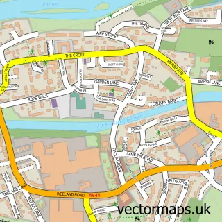
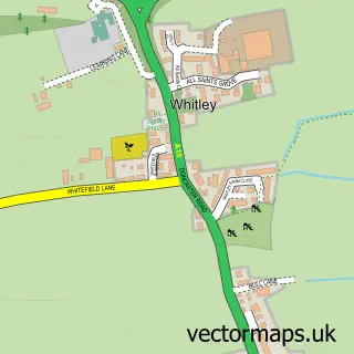
This Beal street map is a detailed vector street map covering a 750m x 750m area. Select a larger area to create and download your own vector street map of Beal.
The 750-metre map sample for Beal covers 179 mapped buildings and approximately 13.1 km of road detail, of which 16 named roads are named. The immediate area includes 1 pub and 2 MOT stations within 2 miles. The wider area around Beal features 1 food and drink venue. To create a larger or custom map of Beal, the map builder lets you define your own coverage area and download editable SVG, PDF and PNG files.
Create a larger editable map of Beal
Choose any area you need and generate a high-quality vector map instantly. Perfect for print, planning, design, business and personal use.

This Beal street map in North Yorkshire is available as downloadable SVG, PDF and PNG map files, or as a printed map for planning, business, display, education, local information and design work. You can also create a larger custom map area using the map selector.
What this Beal map sample shows
Beal lies within Beal Cp parish, part of Monk Fryston ward in the North Yorkshire local authority area. The postcode geography for this area includes the DN postcode area, the DN14 postcode district and the DN14 0 postcode sector. Residents fall under the Nhs Humber And North Yorkshire Integrated Care Board for NHS services.
Local features near Beal
Within 2 milesAmenities and services in and around Beal.
Administrative and postcode information for Beal
Beal lies within Beal Cp parish, part of Monk Fryston ward in the North Yorkshire local authority area. The postcode geography for this area includes the DN postcode area, the DN14 postcode district and the DN14 0 postcode sector. Residents fall under the Nhs Humber And North Yorkshire Integrated Care Board for NHS services.
Nearby street map samples around Beal


More street maps in North Yorkshire
750 metre map area coverage
Boundary, postcode and point of interest information for the 750m x 750m rectangle centred on this sample map.
Boundaries containing map centre
Constituency: Selby Co Const
District: North Yorkshire
Icb: NHS Humber and North Yorkshire ICB
Parish: Beal CP
Police Force: north yorkshire
Postcode District: DN14
Postcode Sector: DN14 0
Nearby boundaries intersecting sample
No additional intersecting boundaries found.
Postcode coverage
POI category counts
Preschool: 2
Advertising Agency: 1
Building Supply Store: 1
Business Consulting: 1
Community Center: 1
Counseling And Mental Health: 1
Graphic Designer: 1
Marketing Agency: 1
Motorcycle Repair: 1
Pet Groomer: 1
Sample points of interest
- Local-eyes
- Steve Wright Ltd
- Keldale Business Services
- Beal Village Hall Trust
- Yorkshire Hypnotherapy Training
- Visible Thoughts
- Summit 4 Ltd.
- Pro Action
- Precious Paws Grooming Salon
- Irene Cooper Photography
- Olive Tree Day Nursery
- Olive Tree Day Nursery Beal Dn14 0sq
Create a larger editable map of Beal
This sample shows only a 750 metre area. To create a larger map of Beal, use our map builder to choose your own coverage area, add titles and download editable SVG, PDF and PNG files.
Create a custom map of Beal