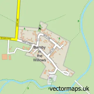
This Beckingham street map is a detailed vector street map covering a 750m x 750m area. Select a larger area to create and download your own vector street map of Beckingham.
The 750-metre map sample for Beckingham covers 112 mapped buildings and approximately 14.7 km of road detail, of which 9 named roads are named. The immediate area includes 1 MOT station within 2 miles. The wider area around Beckingham features 1 food and drink venue. To create a larger or custom map of Beckingham, the map builder lets you define your own coverage area and download editable SVG, PDF and PNG files.
Create a larger editable map of Beckingham
Choose any area you need and generate a high-quality vector map instantly. Perfect for print, planning, design, business and personal use.

This Beckingham street map in Lincolnshire is available as downloadable SVG, PDF and PNG map files, or as a printed map for planning, business, display, education, local information and design work. You can also create a larger custom map area using the map selector.
What this Beckingham map sample shows
Beckingham lies within Beckingham Cp parish, part of Bassingham And Brant Broughton ward in the North Kesteven District local authority area. The postcode geography for this area includes the LN postcode area, the LN5 postcode district and the LN5 0 postcode sector. Residents fall under the Nhs Lincolnshire Integrated Care Board for NHS services.
Local features near Beckingham
Within 2 milesAmenities and services in and around Beckingham.
Administrative and postcode information for Beckingham
The local authority covering Beckingham is North Kesteven District, within the county of Lincolnshire. The settlement lies within Bassingham And Brant Broughton ward and Beckingham Cp civil parish. The LN5 postcode district and LN5 0 postcode sector serve the immediate area. NHS provision in the area is delivered through United Lincolnshire Hospitals Nhs Trust.
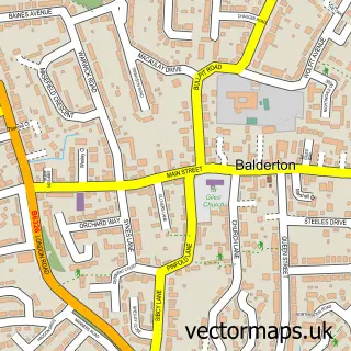
Nearby street map samples around Beckingham

More street maps in Lincolnshire
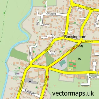
750 metre map area coverage
Boundary, postcode and point of interest information for the 750m x 750m rectangle centred on this sample map.
Boundaries containing map centre
Constituency: Sleaford and North Hykeham Co Const
County: Lincolnshire County
District: North Kesteven District
Icb: NHS Lincolnshire ICB
Parish: Beckingham CP
Police Force: lincolnshire
Postcode District: LN5
Postcode Sector: LN5 0
Ward: Navenby & Brant Broughton Ward
Nearby boundaries intersecting sample
Constituency: Newark Co Const
County: Nottinghamshire County
District: Newark and Sherwood District
Parish: Barnby in the Willows CP
Police Force: nottinghamshire
Postcode District: NG24
Postcode Sector: NG24 2
Ward: Balderton North & Coddington Ward
Postcode coverage
POI category counts
Anglican Church: 1
Automotive Repair: 1
Charity Organization: 1
Community Services Non Profits: 1
Costume Store: 1
Gastropub: 1
Landscaping: 1
Pet Services: 1
Restaurant: 1
Sample points of interest
- All Saints
- G W Webb & Sons
- Gardens Restore our Wellbeing
- Beckingham Village Social Club.
- Lizee Tutu
- Pack Horse Inn
- Applewhite Garden Design
- Go Play
- Black Swan
Create a larger editable map of Beckingham
This sample shows only a 750 metre area. To create a larger map of Beckingham, use our map builder to choose your own coverage area, add titles and download editable SVG, PDF and PNG files.
Create a custom map of Beckingham