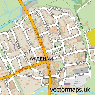
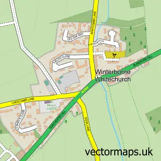
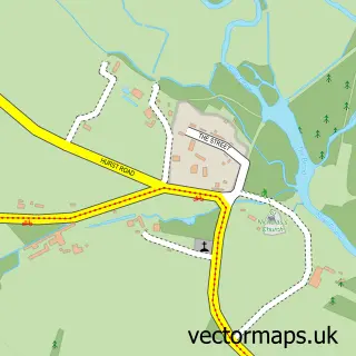
This Bere Regis street map is a detailed vector street map covering a 750m x 750m area. Select a larger area to create and download your own vector street map of Bere Regis.
The 750-metre map sample for Bere Regis covers 268 mapped buildings and approximately 17.0 km of road detail, of which 23 named roads are named. The immediate area includes 1 GP surgery, 2 pubs and 1 MOT station. The wider area around Bere Regis features 3 food and drink venues, 1 hotel and 1 campsite within 2 miles. To create a larger or custom map of Bere Regis, the map builder lets you define your own coverage area and download editable SVG, PDF and PNG files.
Create a larger editable map of Bere Regis
Choose any area you need and generate a high-quality vector map instantly. Perfect for print, planning, design, business and personal use.

This Bere Regis street map in Dorset is available as downloadable SVG, PDF and PNG map files, or as a printed map for planning, business, display, education, local information and design work. You can also create a larger custom map area using the map selector.
What this Bere Regis map sample shows
Bere Regis lies within Bere Regis Cp parish, part of West Purbeck ward in the Dorset local authority area. The postcode geography for this area includes the BH postcode area, the BH20 postcode district and the BH20 7 postcode sector. Residents fall under the Nhs Dorset Integrated Care Board for NHS services.
Local features near Bere Regis
Within 2 milesAmenities and services in and around Bere Regis.
Administrative and postcode information for Bere Regis
The local authority covering Bere Regis is Dorset, within the county of Dorset. The settlement lies within West Purbeck ward and Bere Regis Cp civil parish. The BH20 postcode district and BH20 7 postcode sector serve the immediate area. NHS provision in the area is delivered through University Hospitals Dorset Nhs Foundation Trust.
Nearby street map samples around Bere Regis

More street maps in Dorset
750 metre map area coverage
Boundary, postcode and point of interest information for the 750m x 750m rectangle centred on this sample map.
Boundaries containing map centre
Constituency: Mid Dorset and North Poole Co Const
District: Dorset
Icb: NHS Dorset ICB
Parish: Bere Regis CP
Police Force: dorset
Postcode District: BH20
Postcode Sector: BH20 7
Ward: West Purbeck Ward
Nearby boundaries intersecting sample
No additional intersecting boundaries found.
Postcode coverage
POI category counts
Beauty Salon: 2
Convenience Store: 2
Doctor: 2
Professional Services: 2
Pub: 2
Scout Hall: 2
Amateur Sports Team: 1
Anglican Church: 1
Atms: 1
Auto Company: 1
Sample points of interest
- Bere Regis FC
- Bere Regis: St John the Baptist
- Shell Bere Regis (581), A 35
- Purbeck MG
- Bere Regis MOT & Service Centre
- Sarah Leigh Cakes
- Queen Lashes & Aesthetics Dorset
- Beautiful You
- HairVisions BereRegis
- Village Hall Bere Regis
- Bere Regis Congregational Chapel
- Butterfly Conservation
Create a larger editable map of Bere Regis
This sample shows only a 750 metre area. To create a larger map of Bere Regis, use our map builder to choose your own coverage area, add titles and download editable SVG, PDF and PNG files.
Create a custom map of Bere Regis