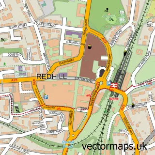
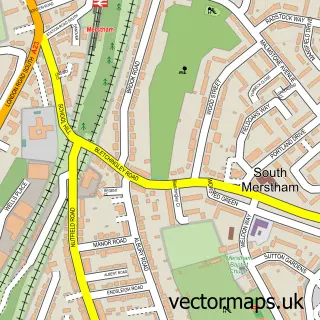
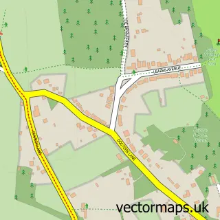
This Bletchingley street map is a detailed vector street map covering a 750m x 750m area. Select a larger area to create and download your own vector street map of Bletchingley.
The 750-metre map sample for Bletchingley covers 201 mapped buildings and approximately 10.8 km of road detail, of which 16 named roads are named. The immediate area includes 1 GP surgery within 2 miles, 1 pub and 3 MOT stations within 2 miles. The wider area around Bletchingley features 1 tourism point of interest, 1 food and drink venue and 1 hotel. To create a larger or custom map of Bletchingley, the map builder lets you define your own coverage area and download editable SVG, PDF and PNG files.
Create a larger editable map of Bletchingley
Choose any area you need and generate a high-quality vector map instantly. Perfect for print, planning, design, business and personal use.

This Bletchingley street map in Surrey is available as downloadable SVG, PDF and PNG map files, or as a printed map for planning, business, display, education, local information and design work. You can also create a larger custom map area using the map selector.
What this Bletchingley map sample shows
Bletchingley lies within Bletchingley Cp parish, part of Bletchingley And Nutfield ward in the Tandridge District local authority area. The postcode geography for this area includes the RH postcode area, the RH1 postcode district and the RH1 4 postcode sector. Residents fall under the Nhs Surrey Heartlands Integrated Care Board for NHS services.
Local features near Bletchingley
Within 2 milesAmenities and services in and around Bletchingley.
Administrative and postcode information for Bletchingley
The local authority covering Bletchingley is Tandridge District, within the county of Surrey. The settlement lies within Bletchingley And Nutfield ward and Bletchingley Cp civil parish. The RH1 postcode district and RH1 4 postcode sector serve the immediate area. NHS provision in the area is delivered through Surrey And Sussex Healthcare Nhs Trust.
Nearby street map samples around Bletchingley

More street maps in Surrey
750 metre map area coverage
Boundary, postcode and point of interest information for the 750m x 750m rectangle centred on this sample map.
Boundaries containing map centre
Constituency: East Surrey Co Const
County: Surrey County
District: Tandridge District
Icb: NHS Surrey and Sussex ICB
Parish: Bletchingley CP
Police Force: surrey
Postcode District: RH1
Postcode Sector: RH1 4
Ward: Bletchingley & Nutfield Ward
Nearby boundaries intersecting sample
No additional intersecting boundaries found.
Postcode coverage
POI category counts
Art Gallery: 3
Business Management Services: 3
Auction House: 2
Event Planning: 2
Hair Salon: 2
Professional Services: 2
Alternative Medicine: 1
Anglican Church: 1
Antique Store: 1
Auto Detailing: 1
Sample points of interest
- Reigate Osteopathic Clinic
- Bletchingley, St Mary the Virgin
- John Anthony
- Art Unlocked
- Cider House Galleries
- The Cider House Galleries Ltd.
- Lawrences Auctioneers
- Lawrences Auctioneers
- Granger's Car Valet
- Hedgers Cider House
- MJ Barbers
- The Beauty Lounge
Create a larger editable map of Bletchingley
This sample shows only a 750 metre area. To create a larger map of Bletchingley, use our map builder to choose your own coverage area, add titles and download editable SVG, PDF and PNG files.
Create a custom map of Bletchingley