Vector Maps logo
Home Why it works Popular maps Districts Samples Customizer Create Your Map
VectorMaps.uk
Home Popular maps Districts Samples Customizer Create Your Map Privacy Disclaimer
Home / UK Maps / Stirling and Falkirk / Bo'ness Map

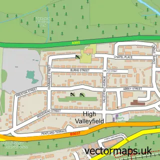
This Bo'ness street map is a detailed vector street map covering a 750m x 750m area. Select a larger area to create and download your own vector street map of Bo'ness.

Bo'ness is a town in Stirling And Falkirk, in the Central Scotland of Scotland. Historically, the area formed part of West Lothian. The settlement falls within the Linlithgow And East Falkirk parliamentary constituency. It is served by the EH51 postcode d

The 750-metre map sample for Bo'ness covers 195 mapped buildings and approximately 15.3 km of road detail, of which 35 named roads are named. The immediate area includes 2 GP surgeries within 2 miles, 2 pubs and 2 MOT stations, with 6 within 2 miles. The wider area around Bo'ness features 2 tourism points of interest and 9 food and drink venues. To create a larger or custom map of Bo'ness, the map builder lets you define your own coverage area and download editable SVG, PDF and PNG files.

195Buildings
15.25 kmRoads
35Named roads
0Residents within 2 miles
Create your own

Create a larger editable map of Bo'ness

Choose any area you need and generate a high-quality vector map instantly. Perfect for print, planning, design, business and personal use.

Choose any location
Editable SVG files
Any size up to A0
PDF, PNG & more
Instant download
High quality guaranteed
Create My Custom Map
Secure, private & no credit card required
Bo'ness Vector Street Map
750m Sample
Bo'ness vector street map sample showing roads, buildings and local features in a 750 metre preview area
Buy Bo'ness Map Print from £12.95 Buy Bo'ness Digital Map from £6

This Bo'ness street map in Stirling and Falkirk is available as downloadable SVG, PDF and PNG map files, or as a printed map for planning, business, display, education, local information and design work. You can also create a larger custom map area using the map selector.

What this Bo'ness map sample shows

Bo'ness lies within Falkirk parish, part of Bo'ness And Blackness ward in the Falkirk local authority area. The postcode geography for this area includes the EH postcode area, the EH51 postcode district and the EH51 0 postcode sector. Residents fall under the Forth Valley for NHS services.

Local features near Bo'ness

Within 2 miles

Amenities and services in and around Bo'ness.

2 GP surgeries within 2 miles
2 MOT stations 6 within 2 miles
2 Tourism & leisure
9 Food & drink
2 Pubs
7 Healthcare POIs
3 Vehicle services

Counts are approximate and based on publicly available data.

Administrative and postcode information for Bo'ness

The local authority covering Bo'ness is Falkirk, within the county of Stirling And Falkirk. The settlement lies within Bo'ness And Blackness ward and Falkirk civil parish. The EH51 postcode district and EH51 0 postcode sector serve the immediate area. NHS provision in the area is delivered through Forth Valley.

Parish FALKIRK
Ward Bo'ness and Blackness
District / local authority Falkirk
County Stirling and Falkirk
Historic county West Lothian
Postcode district EH51
Postcode sector EH51 0
Parliamentary constituency Linlithgow and East Falkirk
Region Central Scotland
Country Scotland

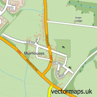
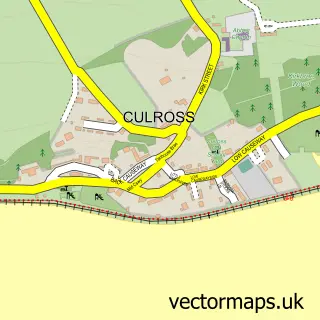
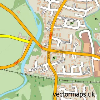
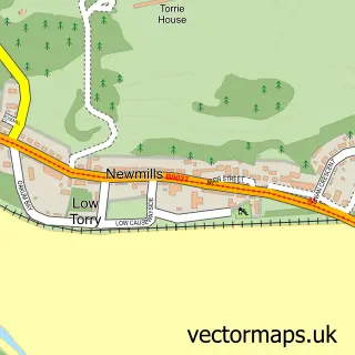
Nearby street map samples around Bo'ness

Street map sample of Dunfermline, Fife Dunfermline City - Fife - 6.7 miles Street map sample of Muirhouses, Stirling and Falkirk Muirhouses Village - Stirling and Falkirk - 1.4 miles Street map sample of Culross, Fife Culross Village - Fife - 2.7 miles Street map sample of Linlithgow Bridge, West Lothian Linlithgow Bridge Village - West Lothian - 3.0 miles Street map sample of Newmills, Fife Newmills Village - Fife - 3.1 miles Street map sample of High Valleyfield, Fife High Valleyfield Village - Fife - 3.1 miles Street map sample of Torryburn, Fife Torryburn Village - Fife - 3.2 miles Street map sample of Blackness, Stirling and Falkirk Blackness Village - Stirling and Falkirk - 3.4 miles Street map sample of Whitecross, Stirling and Falkirk Whitecross Village - Stirling and Falkirk - 3.5 miles Street map sample of Crombie, Fife Crombie Village - Fife - 3.7 miles

More street maps in Stirling and Falkirk

Street map sample of Muirhouses, Stirling and Falkirk Muirhouses Village - 1.4 miles Street map sample of Blackness, Stirling and Falkirk Blackness Village - 3.4 miles Street map sample of Whitecross, Stirling and Falkirk Whitecross Village - 3.5 miles Street map sample of Polmont, Stirling and Falkirk Polmont Village - 4.3 miles Street map sample of Grangemouth, Stirling and Falkirk Grangemouth Town - 4.5 miles

750 metre map area coverage

Boundary, postcode and point of interest information for the 750m x 750m rectangle centred on this sample map.

Boundaries containing map centre

Constituency: Bathgate and Linlithgow Co Const

District: Falkirk

Icb: Forth Valley

Postcode District: EH51

Postcode Sector: EH51 9

Ward: Bo'ness and Blackness Ward

Nearby boundaries intersecting sample

Postcode Sector: EH51 0

Postcode coverage

EH51 EH51 9 EH51 0

POI category counts

Beauty Salon: 10

Flowers And Gifts Shop: 8

Church Cathedral: 5

Banks: 4

Barber: 4

Education: 4

Professional Services: 4

Automotive Repair: 3

Cafe: 3

Cinema: 3

Sample points of interest

  • Cornerstone Accounting Accountant
  • Lime Thistle Acupuncture
  • Sharp Graphics Advertising Agency
  • Healing Hands Alternative Medicine
  • Sunrise Holistic Alternative Medicine
  • Firefly Art Gallery
  • Red Leaf Studio Art School
  • Tesco Bank Atms
  • Derek Heeps Yard Automotive
  • Autoparts Car Breakers Automotive Parts And Accessories
  • Douglas Haston & Son Ltd Automotive Parts And Accessories
  • Forrest Autos Automotive Repair

Create a larger editable map of Bo'ness

This sample shows only a 750 metre area. To create a larger map of Bo'ness, use our map builder to choose your own coverage area, add titles and download editable SVG, PDF and PNG files.

Create a custom map of Bo'ness

Phone 01751 473136 | Copyright Vectormaps.uk 2026

Samples Customizer Privacy Disclaimer
Bo'ness Vector Street Map
Bo'ness enlarged street map sample showing a 750 metre preview area