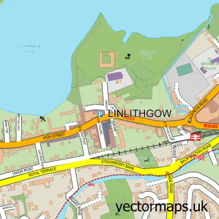
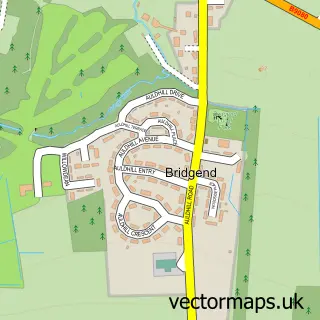
This Linlithgow Bridge street map is a detailed vector street map covering a 750m x 750m area. Select a larger area to create and download your own vector street map of Linlithgow Bridge.
The 750-metre map sample for Linlithgow Bridge covers 282 mapped buildings and approximately 18.1 km of road detail, of which 22 named roads are named. The immediate area includes 1 GP surgery within 2 miles, 1 pub and 2 MOT stations within 2 miles. The wider area around Linlithgow Bridge features 1 food and drink venue. To create a larger or custom map of Linlithgow Bridge, the map builder lets you define your own coverage area and download editable SVG, PDF and PNG files.
Create a larger editable map of Linlithgow Bridge
Choose any area you need and generate a high-quality vector map instantly. Perfect for print, planning, design, business and personal use.

This Linlithgow Bridge street map in West Lothian is available as downloadable SVG, PDF and PNG map files, or as a printed map for planning, business, display, education, local information and design work. You can also create a larger custom map area using the map selector.
What this Linlithgow Bridge map sample shows
Linlithgow Bridge lies within West Lothian parish, part of Linlithgow ward in the West Lothian local authority area. The postcode geography for this area includes the EH postcode area, the EH49 postcode district and the EH49 7 postcode sector. Residents fall under the Lothian for NHS services.
Local features near Linlithgow Bridge
Within 2 milesAmenities and services in and around Linlithgow Bridge.
Administrative and postcode information for Linlithgow Bridge
The local authority covering Linlithgow Bridge is West Lothian, within the county of West Lothian. The settlement lies within Linlithgow ward and West Lothian civil parish. The EH49 postcode district and EH49 7 postcode sector serve the immediate area. NHS provision in the area is delivered through Lothian.
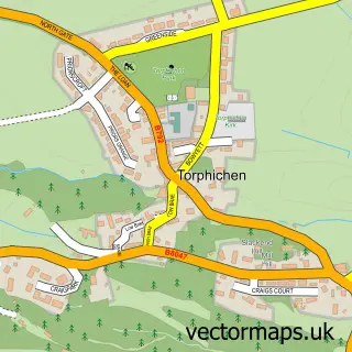
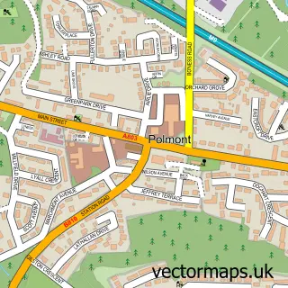
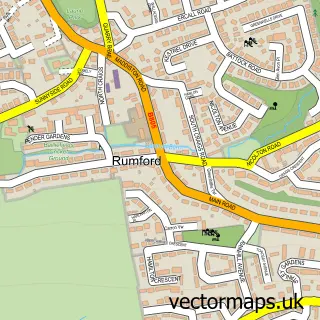
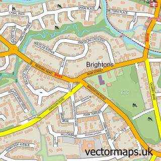
Nearby street map samples around Linlithgow Bridge

More street maps in West Lothian
750 metre map area coverage
Boundary, postcode and point of interest information for the 750m x 750m rectangle centred on this sample map.
Boundaries containing map centre
Constituency: Bathgate and Linlithgow Co Const
District: West Lothian
Icb: Lothian
Postcode District: EH49
Postcode Sector: EH49 7
Ward: Linlithgow Ward
Nearby boundaries intersecting sample
Constituency: Falkirk Co Const
District: Falkirk
Icb: Forth Valley
Postcode Sector: EH49 6
Ward: Upper Braes Ward
Postcode coverage
POI category counts
Professional Services: 4
Supermarket: 3
Construction Services: 2
Convenience Store: 2
Department Store: 2
Scout Hall: 2
Shopping: 2
Warehouses: 2
Asian Fusion Restaurant: 1
Automotive Repair: 1
Sample points of interest
- Ashmaan Tandoori Restaurant
- G M Vehicle Transport & Recovery
- The Crown Arms
- Glenavon House
- G M Carpets & Flooring
- Keddie Consulting
- Biocair
- GM Carpets and Flooring
- ARCO East Scotland
- Barry Nicholson Joinery
- GK Joinery "Why Move, When We Can Improve?"
- Londis Linlithgow
Create a larger editable map of Linlithgow Bridge
This sample shows only a 750 metre area. To create a larger map of Linlithgow Bridge, use our map builder to choose your own coverage area, add titles and download editable SVG, PDF and PNG files.
Create a custom map of Linlithgow Bridge