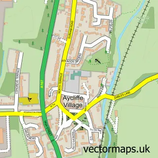
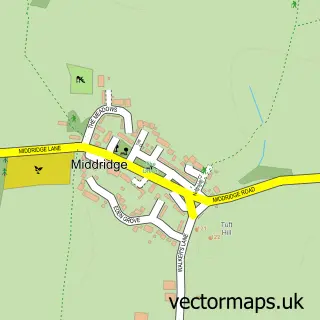
This Brafferton street map is a detailed vector street map covering a 750m x 750m area. Select a larger area to create and download your own vector street map of Brafferton.
The 750-metre map sample for Brafferton covers 56 mapped buildings and approximately 6.8 km of road detail, of which 3 named roads are named. The immediate area includes 3 MOT stations within 2 miles. The wider area around Brafferton features 1 campsite within 2 miles. To create a larger or custom map of Brafferton, the map builder lets you define your own coverage area and download editable SVG, PDF and PNG files.
Create a larger editable map of Brafferton
Choose any area you need and generate a high-quality vector map instantly. Perfect for print, planning, design, business and personal use.

This Brafferton street map in Durham is available as downloadable SVG, PDF and PNG map files, or as a printed map for planning, business, display, education, local information and design work. You can also create a larger custom map area using the map selector.
What this Brafferton map sample shows
Brafferton lies within Brafferton Cp parish, part of Heighington & Coniscliffe ward in the Darlington (B) local authority area. The postcode geography for this area includes the DL postcode area, the DL1 postcode district and the DL1 3 postcode sector. Residents fall under the Nhs North East And North Cumbria Integrated Care Board for NHS services.
Local features near Brafferton
Within 2 milesAmenities and services in and around Brafferton.
Administrative and postcode information for Brafferton
The local authority covering Brafferton is Darlington (B), within the county of Durham. The settlement lies within Heighington & Coniscliffe ward and Brafferton Cp civil parish. The DL1 postcode district and DL1 3 postcode sector serve the immediate area. NHS provision in the area is delivered through County Durham And Darlington Nhs Foundation Trust.
Nearby street map samples around Brafferton


More street maps in Durham
750 metre map area coverage
Boundary, postcode and point of interest information for the 750m x 750m rectangle centred on this sample map.
Boundaries containing map centre
Constituency: Darlington Co Const
District: Darlington (B)
Icb: NHS North East and North Cumbria ICB
Parish: Brafferton CP
Police Force: durham
Postcode District: DL1
Postcode Sector: DL1 3
Ward: Heighington & Coniscliffe Ward
Nearby boundaries intersecting sample
Constituency: Newton Aycliffe and Spennymoor Co Const
District: County Durham
Parish: Coatham Mundeville CP, Great Aycliffe CP
Postcode coverage
POI category counts
Bar: 1
Community Center: 1
Education: 1
Home Cleaning: 1
Professional Services: 1
Sample points of interest
- Haughton-Le-Skerne Working Mens Club
- Brafferton Village Hall
- R H Associates Total Business Solutions
- Tidal Cleaning Services
- Aycliffe Beekeepers Association
Create a larger editable map of Brafferton
This sample shows only a 750 metre area. To create a larger map of Brafferton, use our map builder to choose your own coverage area, add titles and download editable SVG, PDF and PNG files.
Create a custom map of Brafferton