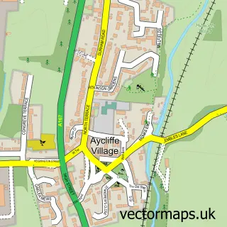
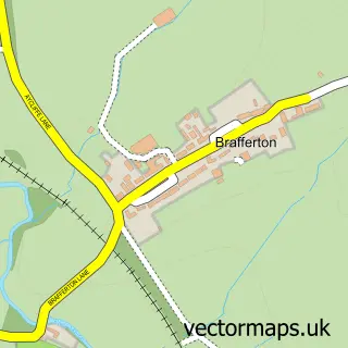
This Newton Aycliffe street map is a detailed vector street map covering a 750m x 750m area. Select a larger area to create and download your own vector street map of Newton Aycliffe.
The 750-metre map sample for Newton Aycliffe covers 254 mapped buildings and approximately 19.9 km of road detail, of which 46 named roads are named. The immediate area includes 1 school, 3 GP surgeries within 2 miles and 10 MOT stations within 2 miles. The wider area around Newton Aycliffe features 6 food and drink venues and 1 campsite within 2 miles. To create a larger or custom map of Newton Aycliffe, the map builder lets you define your own coverage area and download editable SVG, PDF and PNG files.
Create a larger editable map of Newton Aycliffe
Choose any area you need and generate a high-quality vector map instantly. Perfect for print, planning, design, business and personal use.

This Newton Aycliffe street map in Durham is available as downloadable SVG, PDF and PNG map files, or as a printed map for planning, business, display, education, local information and design work. You can also create a larger custom map area using the map selector.
What this Newton Aycliffe map sample shows
Newton Aycliffe lies within Great Aycliffe Cp parish, part of Aycliffe East ward in the County Durham local authority area. The postcode geography for this area includes the DL postcode area, the DL5 postcode district and the DL5 6 postcode sector. Residents fall under the Nhs North East And North Cumbria Integrated Care Board for NHS services.
Local features near Newton Aycliffe
Within 2 milesAmenities and services in and around Newton Aycliffe.
Administrative and postcode information for Newton Aycliffe
Newton Aycliffe lies within Great Aycliffe Cp parish, part of Aycliffe East ward in the County Durham local authority area. The postcode geography for this area includes the DL postcode area, the DL5 postcode district and the DL5 6 postcode sector. Residents fall under the Nhs North East And North Cumbria Integrated Care Board for NHS services.
Nearby street map samples around Newton Aycliffe


More street maps in Durham
750 metre map area coverage
Boundary, postcode and point of interest information for the 750m x 750m rectangle centred on this sample map.
Boundaries containing map centre
Constituency: Newton Aycliffe and Spennymoor Co Const
District: County Durham
Icb: NHS North East and North Cumbria ICB
Parish: Great Aycliffe CP
Police Force: durham
Postcode District: DL5
Postcode Sector: DL5 5
Nearby boundaries intersecting sample
Postcode Sector: DL5 4
Postcode coverage
POI category counts
Banks: 7
Bakery: 3
Coffee Shop: 3
Dentist: 3
Discount Store: 3
Hair Salon: 3
Indian Restaurant: 3
Passport And Visa Services: 3
Real Estate Agent: 3
Rental Kiosks: 3
Sample points of interest
- St Clare
- Bargain Buys Retail Ltd.
- Aycliffe Framers & Engravers
- Newton Aycliffe - Beveridge Way
- Defoe Court Care Home
- St Clare's Court Care Home
- Croxdale Garage Fast Fit
- MIHAI AUTOS Repair
- Vehicle Conversion Solutions LTD
- Greggs
- Greggs
- Scrummy Somethings By Jessica
Create a larger editable map of Newton Aycliffe
This sample shows only a 750 metre area. To create a larger map of Newton Aycliffe, use our map builder to choose your own coverage area, add titles and download editable SVG, PDF and PNG files.
Create a custom map of Newton Aycliffe