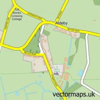
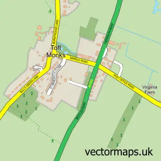
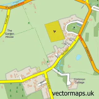
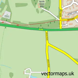
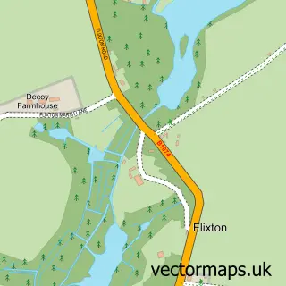
This Burgh St Peter street map is a detailed vector street map covering a 750m x 750m area. Select a larger area to create and download your own vector street map of Burgh St Peter.
The 750-metre map sample for Burgh St Peter covers 151 mapped buildings and approximately 7.8 km of road detail, of which 9 named roads are named. The wider area around Burgh St Peter features 2 tourism points of interest and 1 campsite within 2 miles. To create a larger or custom map of Burgh St Peter, the map builder lets you define your own coverage area and download editable SVG, PDF and PNG files.
Create a larger editable map of Burgh St Peter
Choose any area you need and generate a high-quality vector map instantly. Perfect for print, planning, design, business and personal use.

This Burgh St Peter street map in Norfolk is available as downloadable SVG, PDF and PNG map files, or as a printed map for planning, business, display, education, local information and design work. You can also create a larger custom map area using the map selector.
What this Burgh St Peter map sample shows
Burgh St Peter lies within Burgh St. Peter Cp parish, part of Thurlton ward in the South Norfolk District local authority area. The postcode geography for this area includes the NR postcode area, the NR34 postcode district and the NR34 0 postcode sector. Residents fall under the Nhs Norfolk And Waveney Integrated Care Board for NHS services.
Local features near Burgh St Peter
Within 2 milesAmenities and services in and around Burgh St Peter.
Administrative and postcode information for Burgh St Peter
The local authority covering Burgh St Peter is South Norfolk District, within the county of Norfolk. The settlement lies within Thurlton ward and Burgh St. Peter Cp civil parish. The NR34 postcode district and NR34 0 postcode sector serve the immediate area. NHS provision in the area is delivered through James Paget University Hospitals Nhs Foundation Trust.
Nearby street map samples around Burgh St Peter
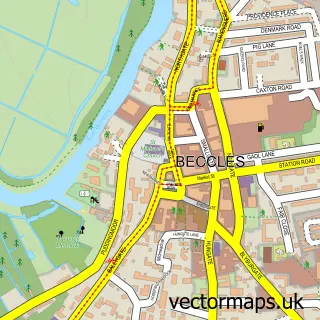

More street maps in Norfolk
750 metre map area coverage
Boundary, postcode and point of interest information for the 750m x 750m rectangle centred on this sample map.
Boundaries containing map centre
Constituency: South Norfolk Co Const
County: Norfolk County
District: South Norfolk District
Icb: NHS Norfolk and Waveney ICB
Parish: Burgh St. Peter CP
Police Force: norfolk
Postcode District: NR34
Postcode Sector: NR34 0
Ward: Thurlton Ward
Nearby boundaries intersecting sample
Parish: Aldeby CP, Wheatacre CP
Postcode coverage
POI category counts
Auto Electrical Repair: 2
Campground: 2
Agriculture: 1
Candy Store: 1
Car Wash: 1
Disability Law: 1
Fitness Trainer: 1
Scout Hall: 1
Sample points of interest
- The Glam Pooch - Dog groomers
- Last M F
- M F Last Ltd.
- Brambells Glamping
- Brambells Glamping
- Ali's Sweet Dreamz
- Wards Car Valeting Services
- Sense Centre - Aldeby, Suffolk (Aldeby Resource Centre)
- Grebe Coaches
- 1st Burgh St Peter & Raveningham Sea Scouts Group
Create a larger editable map of Burgh St Peter
This sample shows only a 750 metre area. To create a larger map of Burgh St Peter, use our map builder to choose your own coverage area, add titles and download editable SVG, PDF and PNG files.
Create a custom map of Burgh St Peter