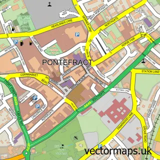
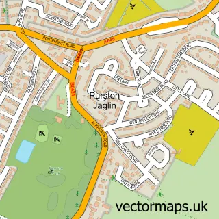
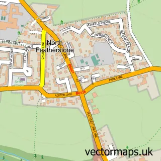
This Carleton street map is a detailed vector street map covering a 750m x 750m area. Select a larger area to create and download your own vector street map of Carleton.
The 750-metre map sample for Carleton covers 209 mapped buildings and approximately 9.7 km of road detail, of which 18 named roads are named. The immediate area includes 1 school, 3 GP surgeries within 2 miles and 15 MOT stations within 2 miles. The wider area around Carleton features 1 tourism point of interest. To create a larger or custom map of Carleton, the map builder lets you define your own coverage area and download editable SVG, PDF and PNG files.
Create a larger editable map of Carleton
Choose any area you need and generate a high-quality vector map instantly. Perfect for print, planning, design, business and personal use.

This Carleton street map in West Yorkshire is available as downloadable SVG, PDF and PNG map files, or as a printed map for planning, business, display, education, local information and design work. You can also create a larger custom map area using the map selector.
What this Carleton map sample shows
Carleton lies within Wakefield District (B) parish, part of Pontefract North ward in the Wakefield District (B) local authority area. The postcode geography for this area includes the WF postcode area, the WF8 postcode district and the WF8 1 postcode sector. Residents fall under the Nhs West Yorkshire Integrated Care Board for NHS services.
Local features near Carleton
Within 2 milesAmenities and services in and around Carleton.
Administrative and postcode information for Carleton
Carleton lies within Wakefield District (B) parish, part of Pontefract North ward in the Wakefield District (B) local authority area. The postcode geography for this area includes the WF postcode area, the WF8 postcode district and the WF8 1 postcode sector. Residents fall under the Nhs West Yorkshire Integrated Care Board for NHS services.
Nearby street map samples around Carleton

More street maps in West Yorkshire
750 metre map area coverage
Boundary, postcode and point of interest information for the 750m x 750m rectangle centred on this sample map.
Boundaries containing map centre
Constituency: Pontefract, Castleford and Knottingley Co Const
District: Wakefield District (B)
Icb: NHS West Yorkshire ICB
Police Force: west yorkshire
Postcode District: WF8
Postcode Sector: WF8 3
Ward: Pontefract South Ward
Nearby boundaries intersecting sample
Postcode Sector: WF8 2
Postcode coverage
POI category counts
Education: 3
Dog Walkers: 2
Elementary School: 2
Social Service Organizations: 2
Advertising Agency: 1
Anglican Church: 1
Arts And Entertainment: 1
Beauty And Spa: 1
Beauty Salon: 1
Building Supply Store: 1
Sample points of interest
- Brand to Market
- St Michael the Archangel, Carleton
- West Yorkshire Astronomical Society
- Half Moon Beauty
- Lilac Heaven
- One of a Kind Designs
- The Grange - Carleton Grange Trust
- Carleton Tiling
- Mollies Pet Patrol
- Moon Walk Dog Walking and Pet Services
- Elite Training
- First 4 Health Training
Create a larger editable map of Carleton
This sample shows only a 750 metre area. To create a larger map of Carleton, use our map builder to choose your own coverage area, add titles and download editable SVG, PDF and PNG files.
Create a custom map of Carleton