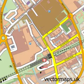
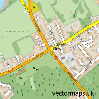
This Chase Cross street map is a detailed vector street map covering a 750m x 750m area. Select a larger area to create and download your own vector street map of Chase Cross.
The 750-metre map sample for Chase Cross covers 337 mapped buildings and approximately 13.5 km of road detail, of which 22 named roads are named. The immediate area includes 1 school, 13 GP surgeries within 2 miles and 16 MOT stations within 2 miles. The wider area around Chase Cross features 1 tourism point of interest and 1 food and drink venue. To create a larger or custom map of Chase Cross, the map builder lets you define your own coverage area and download editable SVG, PDF and PNG files.
Create a larger editable map of Chase Cross
Choose any area you need and generate a high-quality vector map instantly. Perfect for print, planning, design, business and personal use.

This Chase Cross street map in Greater London is available as downloadable SVG, PDF and PNG map files, or as a printed map for planning, business, display, education, local information and design work. You can also create a larger custom map area using the map selector.
What this Chase Cross map sample shows
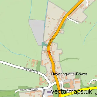
Chase Cross lies within Greater London Authority parish, part of Havering Park ward in the Havering London Boro local authority area. The postcode geography for this area includes the RM postcode area, the RM4 postcode district and the RM4 1 postcode sector. Residents fall under the Nhs North East London Integrated Care Board for NHS services.
Local features near Chase Cross
Within 2 milesAmenities and services in and around Chase Cross.
Administrative and postcode information for Chase Cross
Chase Cross lies within Greater London Authority parish, part of Havering Park ward in the Havering London Boro local authority area. The postcode geography for this area includes the RM postcode area, the RM4 postcode district and the RM4 1 postcode sector. Residents fall under the Nhs North East London Integrated Care Board for NHS services.
Nearby street map samples around Chase Cross

More street maps in Greater London
750 metre map area coverage
Boundary, postcode and point of interest information for the 750m x 750m rectangle centred on this sample map.
Boundaries containing map centre
Constituency: Romford Boro Const
County: Greater London Authority
District: Havering London Boro
Icb: NHS North East London ICB
Police Force: metropolitan
Postcode District: RM1
Postcode Sector: RM1 4
Ward: Havering-atte-Bower Ward
Nearby boundaries intersecting sample
Postcode District: RM5
Postcode Sector: RM5 3
Ward: Marshalls & Rise Park Ward
Postcode coverage
POI category counts
Retirement Home: 2
School: 2
Banks: 1
Building Supply Store: 1
Cafe: 1
Church Cathedral: 1
College University: 1
Contractor: 1
Dog Trainer: 1
Elementary School: 1
Sample points of interest
- NatWest
- Reston Scaffold Supplies
- Olive Tree Cafe
- Henham, Elsenham and Ugley Churches
- Havering Adult College
- New Dawn Business Conglomerate
- Crazy About Your K9s
- Immanuel School
- Evri ParcelShop
- Havering Gymnastics Club
- Bower Park School
- Radecare
Create a larger editable map of Chase Cross
This sample shows only a 750 metre area. To create a larger map of Chase Cross, use our map builder to choose your own coverage area, add titles and download editable SVG, PDF and PNG files.
Create a custom map of Chase Cross