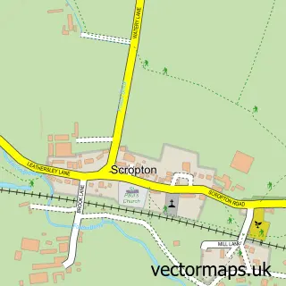
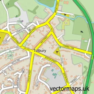
This Church Broughton street map is a detailed vector street map covering a 750m x 750m area. Select a larger area to create and download your own vector street map of Church Broughton.
The 750-metre map sample for Church Broughton covers 118 mapped buildings and approximately 10.2 km of road detail, of which 12 named roads are named. The immediate area includes 1 school and 2 pubs. The wider area around Church Broughton features 2 food and drink venues. To create a larger or custom map of Church Broughton, the map builder lets you define your own coverage area and download editable SVG, PDF and PNG files.
Create a larger editable map of Church Broughton
Choose any area you need and generate a high-quality vector map instantly. Perfect for print, planning, design, business and personal use.

This Church Broughton street map in Derbyshire is available as downloadable SVG, PDF and PNG map files, or as a printed map for planning, business, display, education, local information and design work. You can also create a larger custom map area using the map selector.
What this Church Broughton map sample shows
Church Broughton lies within Church Broughton Cp parish, part of Hilton ward in the South Derbyshire District local authority area. The postcode geography for this area includes the DE postcode area, the DE65 postcode district and the DE65 5 postcode sector. Residents fall under the Nhs Derby And Derbyshire Integrated Care Board for NHS services.
Local features near Church Broughton
Within 2 milesAmenities and services in and around Church Broughton.
Administrative and postcode information for Church Broughton
The local authority covering Church Broughton is South Derbyshire District, within the county of Derbyshire. The settlement lies within Hilton ward and Church Broughton Cp civil parish. The DE65 postcode district and DE65 5 postcode sector serve the immediate area. NHS provision in the area is delivered through University Hospitals Of Derby And Burton Nhs Foundation Trust.
Nearby street map samples around Church Broughton

More street maps in Derbyshire
750 metre map area coverage
Boundary, postcode and point of interest information for the 750m x 750m rectangle centred on this sample map.
Boundaries containing map centre
Constituency: Derbyshire Dales Co Const
County: Derbyshire County
District: South Derbyshire District
Icb: NHS Derby and Derbyshire ICB
Parish: Church Broughton CP
Police Force: derbyshire
Postcode District: DE65
Postcode Sector: DE65 5
Ward: Hilton Ward
Nearby boundaries intersecting sample
No additional intersecting boundaries found.
Postcode coverage
POI category counts
Anglican Church: 2
Pub: 2
Bakery: 1
Business Consulting: 1
Church Cathedral: 1
Elementary School: 1
Personal Care Service: 1
Printing Services: 1
Professional Services: 1
Psychic Medium: 1
Sample points of interest
- St Michael and All Angels Church
- The Parish Church of St Michael & All Angels, Church Broughton
- Buffalo Brownies
- Wheatley Consultancy
- Church Broughton
- Church Broughton C of E Primary School
- Hard Days Knight
- Broughton Hub
- What a Waste
- Barbara Bridgford
- Holly Bush
- The Holly Bush
Create a larger editable map of Church Broughton
This sample shows only a 750 metre area. To create a larger map of Church Broughton, use our map builder to choose your own coverage area, add titles and download editable SVG, PDF and PNG files.
Create a custom map of Church Broughton