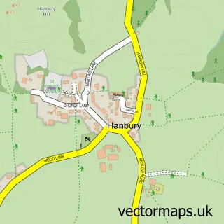
This Sudbury street map is a detailed vector street map covering a 750m x 750m area. Select a larger area to create and download your own vector street map of Sudbury.
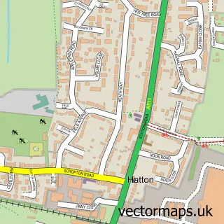
The 750-metre map sample for Sudbury covers 62 mapped buildings and approximately 10.4 km of road detail, of which 4 named roads are named. The immediate area includes 1 school and 2 pubs. The wider area around Sudbury features 5 tourism points of interest and 5 food and drink venues. To create a larger or custom map of Sudbury, the map builder lets you define your own coverage area and download editable SVG, PDF and PNG files.
Create a larger editable map of Sudbury
Choose any area you need and generate a high-quality vector map instantly. Perfect for print, planning, design, business and personal use.

This Sudbury street map in Derbyshire is available as downloadable SVG, PDF and PNG map files, or as a printed map for planning, business, display, education, local information and design work. You can also create a larger custom map area using the map selector.
What this Sudbury map sample shows
Sudbury lies within Sudbury Cp parish, part of Doveridge And Sudbury ward in the Derbyshire Dales District local authority area. The postcode geography for this area includes the DE postcode area, the DE6 postcode district and the DE6 5 postcode sector. Residents fall under the Nhs Derby And Derbyshire Integrated Care Board for NHS services.
Local features near Sudbury
Within 2 milesAmenities and services in and around Sudbury.
Administrative and postcode information for Sudbury
Sudbury lies within Sudbury Cp parish, part of Doveridge And Sudbury ward in the Derbyshire Dales District local authority area. The postcode geography for this area includes the DE postcode area, the DE6 postcode district and the DE6 5 postcode sector. Residents fall under the Nhs Derby And Derbyshire Integrated Care Board for NHS services.
Nearby street map samples around Sudbury

More street maps in Derbyshire
750 metre map area coverage
Boundary, postcode and point of interest information for the 750m x 750m rectangle centred on this sample map.
Boundaries containing map centre
Constituency: Derbyshire Dales Co Const
County: Derbyshire County
District: Derbyshire Dales District
Icb: NHS Derby and Derbyshire ICB
Parish: Sudbury CP
Police Force: derbyshire
Postcode District: DE6
Postcode Sector: DE6 5
Ward: Doveridge & Sudbury Ward
Nearby boundaries intersecting sample
No additional intersecting boundaries found.
Postcode coverage
POI category counts
Cafe: 3
Bridal Shop: 2
Doctor: 2
Graphic Designer: 2
Pub: 2
Anglican Church: 1
Art Gallery: 1
Attractions And Activities: 1
Beauty Salon: 1
Business Management Services: 1
Sample points of interest
- The Parish Church of All Saints', Sudbury
- Hot House Ceramics
- Sudbury Pumpkin Patch
- J.S Hair at the courtyard
- Cupids Carriages
- Pearl and Eve Bridal
- Post Office-Sudbury
- Wild's Butchers
- Sudbury Courtyard
- Sweet Little Café
- The Sudbury Stables
- All Saints' Church
Create a larger editable map of Sudbury
This sample shows only a 750 metre area. To create a larger map of Sudbury, use our map builder to choose your own coverage area, add titles and download editable SVG, PDF and PNG files.
Create a custom map of Sudbury