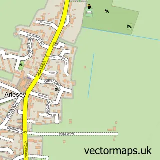
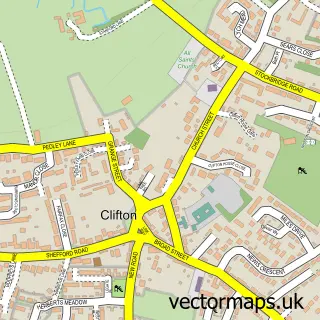
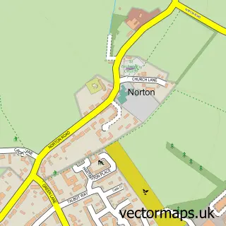
This Church End street map is a detailed vector street map covering a 750m x 750m area. Select a larger area to create and download your own vector street map of Church End.
The 750-metre map sample for Church End covers 344 mapped buildings and approximately 11.5 km of road detail, of which 21 named roads are named. The immediate area includes 1 GP surgery within 2 miles and 5 MOT stations within 2 miles. The wider area around Church End features 1 food and drink venue and 1 campsite within 2 miles. To create a larger or custom map of Church End, the map builder lets you define your own coverage area and download editable SVG, PDF and PNG files.
Create a larger editable map of Church End
Choose any area you need and generate a high-quality vector map instantly. Perfect for print, planning, design, business and personal use.

This Church End street map in Bedfordshire is available as downloadable SVG, PDF and PNG map files, or as a printed map for planning, business, display, education, local information and design work. You can also create a larger custom map area using the map selector.
What this Church End map sample shows
Church End lies within Arlesey Cp parish, part of Arlesey ward in the Central Bedfordshire local authority area. The postcode geography for this area includes the SG postcode area, the SG15 postcode district and the SG15 6 postcode sector. Residents fall under the Nhs Bedfordshire, Luton And Milton Keynes Integrated Care Board for NHS services.
Local features near Church End
Within 2 milesAmenities and services in and around Church End.
Administrative and postcode information for Church End
Church End lies within Arlesey Cp parish, part of Arlesey ward in the Central Bedfordshire local authority area. The postcode geography for this area includes the SG postcode area, the SG15 postcode district and the SG15 6 postcode sector. Residents fall under the Nhs Bedfordshire, Luton And Milton Keynes Integrated Care Board for NHS services.
Nearby street map samples around Church End

More street maps in Bedfordshire
750 metre map area coverage
Boundary, postcode and point of interest information for the 750m x 750m rectangle centred on this sample map.
Boundaries containing map centre
Constituency: Hitchin Co Const
District: Central Bedfordshire
Icb: NHS Central East ICB
Parish: Arlesey CP
Police Force: bedfordshire
Postcode District: SG15
Postcode Sector: SG15 6
Ward: Arlesey & Fairfield Ward
Nearby boundaries intersecting sample
No additional intersecting boundaries found.
Postcode coverage
POI category counts
Anglican Church: 2
Building Supply Store: 2
Caterer: 2
Dog Walkers: 2
Grocery Store: 2
Post Office: 2
Auto Detailing: 1
Bar: 1
Beauty Salon: 1
Building Contractor: 1
Sample points of interest
- St Peter C Of E Church
- St Peter's Arlesey
- Arlesey Hand Carwash
- The Steam Engine
- Hollybrook Beauty
- At Cleaning
- Acc S
- Dean Roofing
- Post Office-Arlesey Church End
- Champagne Caterers
- Lesley Millard
- Temple Lead Works Ltd. & Roofing Services
Create a larger editable map of Church End
This sample shows only a 750 metre area. To create a larger map of Church End, use our map builder to choose your own coverage area, add titles and download editable SVG, PDF and PNG files.
Create a custom map of Church End