Vector Maps logo
Home Why it works Popular maps Districts Samples Customizer Create Your Map
VectorMaps.uk
Home Popular maps Districts Samples Customizer Create Your Map Privacy Disclaimer
Home / UK Maps / North Yorkshire / Colburn Map

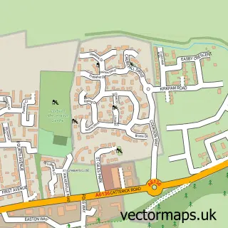
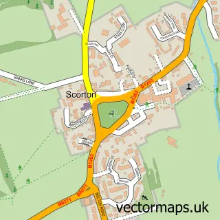
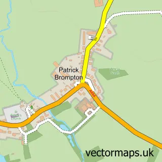
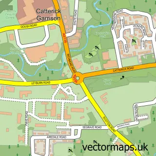
This Colburn street map is a detailed vector street map covering a 750m x 750m area. Select a larger area to create and download your own vector street map of Colburn.

Colburn is a town in North Yorkshire, in the Yorkshire And The Humber of England. Historically, the area formed part of Yorkshire. The settlement falls within the Richmond (Yorks) parliamentary constituency. It is served by the DL9 postcode district, with

The 750-metre map sample for Colburn covers 399 mapped buildings and approximately 17.6 km of road detail, of which 41 named roads are named. The immediate area includes 1 school, 1 GP surgery within 2 miles and 2 MOT stations, with 6 within 2 miles. The wider area around Colburn features 2 tourism points of interest, 3 food and drink venues and 2 campsites within 2 miles. To create a larger or custom map of Colburn, the map builder lets you define your own coverage area and download editable SVG, PDF and PNG files.

399Buildings
17.58 kmRoads
41Named roads
5,129Residents within 2 miles
Create your own

Create a larger editable map of Colburn

Choose any area you need and generate a high-quality vector map instantly. Perfect for print, planning, design, business and personal use.

Choose any location
Editable SVG files
Any size up to A0
PDF, PNG & more
Instant download
High quality guaranteed
Create My Custom Map
Secure, private & no credit card required
Colburn Vector Street Map
750m Sample
Colburn vector street map sample showing roads, buildings and local features in a 750 metre preview area
Buy Colburn Map Print from £12.95 Buy Colburn Digital Map from £6

This Colburn street map in North Yorkshire is available as downloadable SVG, PDF and PNG map files, or as a printed map for planning, business, display, education, local information and design work. You can also create a larger custom map area using the map selector.

What this Colburn map sample shows

Colburn lies within Colburn Cp parish, part of Colburn ward in the North Yorkshire local authority area. The postcode geography for this area includes the DL postcode area, the DL9 postcode district and the DL9 4 postcode sector. Residents fall under the Nhs Humber And North Yorkshire Integrated Care Board for NHS services.

Local features near Colburn

Within 2 miles

Amenities and services in and around Colburn.

1 Schools
2 Campsites within 2 miles
1 GP surgeries within 2 miles
2 MOT stations 6 within 2 miles
2 Tourism & leisure
3 Food & drink
1 Healthcare POIs
8 Vehicle services

Counts are approximate and based on publicly available data.

Administrative and postcode information for Colburn

Colburn lies within Colburn Cp parish, part of Colburn ward in the North Yorkshire local authority area. The postcode geography for this area includes the DL postcode area, the DL9 postcode district and the DL9 4 postcode sector. Residents fall under the Nhs Humber And North Yorkshire Integrated Care Board for NHS services.

Parish Colburn CP
Ward Colburn
District / local authority North Yorkshire
County North Yorkshire
Historic county Yorkshire
Postcode district DL9
Postcode sector DL9 4
Parliamentary constituency Richmond (Yorks)
Region Yorkshire and the Humber
Country England

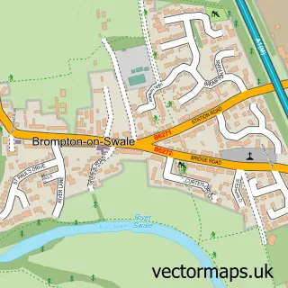
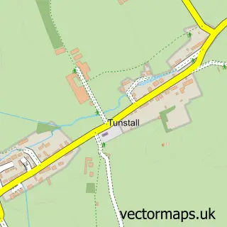
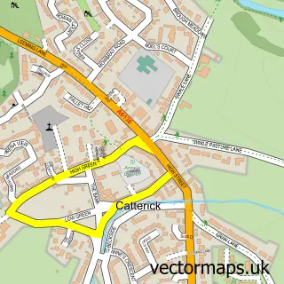
Nearby street map samples around Colburn

Street map sample of Ripon, North Yorkshire Ripon City - North Yorkshire - 18.0 miles Street map sample of Brough With St Giles, North Yorkshire Brough With St Giles Village - North Yorkshire - 0.3 miles Street map sample of Brompton-on-Swale, North Yorkshire Brompton-on-Swale Village - North Yorkshire - 1.2 miles Street map sample of Tunstall, North Yorkshire Tunstall Village - North Yorkshire - 1.6 miles Street map sample of Catterick, North Yorkshire Catterick Village - North Yorkshire - 2.2 miles Street map sample of Scorton, North Yorkshire Scorton Village - North Yorkshire - 3.1 miles Street map sample of Hunton, North Yorkshire Hunton Village - North Yorkshire - 3.8 miles Street map sample of Hudswell, North Yorkshire Hudswell Village - North Yorkshire - 3.9 miles Street map sample of Gilling West, North Yorkshire Gilling West Village - North Yorkshire - 4.5 miles Street map sample of Patrick Brompton, North Yorkshire Patrick Brompton Village - North Yorkshire - 4.7 miles

More street maps in North Yorkshire

Street map sample of Brough With St Giles, North Yorkshire Brough With St Giles Village - 0.3 miles Street map sample of Brompton-on-Swale, North Yorkshire Brompton-on-Swale Village - 1.2 miles Street map sample of Catterick Garrison, North Yorkshire Catterick Garrison Town - 1.5 miles Street map sample of Tunstall, North Yorkshire Tunstall Village - 1.6 miles Street map sample of Catterick, North Yorkshire Catterick Village - 2.2 miles

750 metre map area coverage

Boundary, postcode and point of interest information for the 750m x 750m rectangle centred on this sample map.

Boundaries containing map centre

Constituency: Richmond and Northallerton Co Const

District: North Yorkshire

Icb: NHS Humber and North Yorkshire ICB

Parish: Colburn CP

Police Force: north yorkshire

Postcode District: DL9

Postcode Sector: DL9 4

Nearby boundaries intersecting sample

Parish: Brough with St. Giles CP

Postcode coverage

DL9 DL9 4

POI category counts

Automotive Repair: 6

Counseling And Mental Health: 3

Post Office: 3

Professional Services: 3

Used Car Dealer: 3

Art Gallery: 2

Beauty Salon: 2

Building Supply Store: 2

Coffee Shop: 2

Community Center: 2

Sample points of interest

  • French Connections Advertising Agency
  • St. Cuthbert's, Colburn Anglican Church
  • MJW Electrical Appliance Store
  • The digital emporium Art Gallery
  • Tiger Displays Art Gallery
  • The Cooperative Food (BF) Colburn, Catterick Atms
  • Car-City UK Auto Company
  • Motor Care Discount Centre Auto Parts And Supply Store
  • Braking Solutions Limited Automotive Repair
  • C C Automotive Automotive Repair
  • Competition Braking Products Automotive Repair
  • Jonnoco Automotive Repair

Create a larger editable map of Colburn

This sample shows only a 750 metre area. To create a larger map of Colburn, use our map builder to choose your own coverage area, add titles and download editable SVG, PDF and PNG files.

Create a custom map of Colburn

Phone 01751 473136 | Copyright Vectormaps.uk 2026

Samples Customizer Privacy Disclaimer
Colburn Vector Street Map
Colburn enlarged street map sample showing a 750 metre preview area