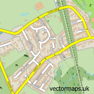
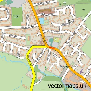
This Coppull street map is a detailed vector street map covering a 750m x 750m area. Select a larger area to create and download your own vector street map of Coppull.
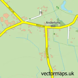
The 750-metre map sample for Coppull covers 586 mapped buildings and approximately 19.4 km of road detail, of which 45 named roads are named. The immediate area includes 1 school, 1 GP surgery, 4 pubs and 2 MOT stations, with 8 within 2 miles. The wider area around Coppull features 1 tourism point of interest and 9 food and drink venues. To create a larger or custom map of Coppull, the map builder lets you define your own coverage area and download editable SVG, PDF and PNG files.
Create a larger editable map of Coppull
Choose any area you need and generate a high-quality vector map instantly. Perfect for print, planning, design, business and personal use.

This Coppull street map in Lancashire is available as downloadable SVG, PDF and PNG map files, or as a printed map for planning, business, display, education, local information and design work. You can also create a larger custom map area using the map selector.
What this Coppull map sample shows
Coppull lies within Coppull Cp parish, part of Chisnall ward in the Chorley District (B) local authority area. The postcode geography for this area includes the PR postcode area, the PR7 postcode district and the PR7 5 postcode sector. Residents fall under the Nhs Lancashire And South Cumbria Integrated Care Board for NHS services.
Local features near Coppull
Within 2 milesAmenities and services in and around Coppull.
Administrative and postcode information for Coppull
Coppull lies within Coppull Cp parish, part of Chisnall ward in the Chorley District (B) local authority area. The postcode geography for this area includes the PR postcode area, the PR7 postcode district and the PR7 5 postcode sector. Residents fall under the Nhs Lancashire And South Cumbria Integrated Care Board for NHS services.
Nearby street map samples around Coppull

More street maps in Lancashire
750 metre map area coverage
Boundary, postcode and point of interest information for the 750m x 750m rectangle centred on this sample map.
Boundaries containing map centre
Constituency: Chorley Co Const
County: Lancashire County
District: Chorley District (B)
Icb: NHS Lancashire and South Cumbria ICB
Parish: Coppull CP
Police Force: lancashire
Postcode District: PR7
Postcode Sector: PR7 5
Ward: Coppull Ward
Nearby boundaries intersecting sample
Postcode Sector: PR7 4
Postcode coverage
POI category counts
Church Cathedral: 5
Hair Salon: 4
Pub: 4
Barber: 3
Beauty Salon: 3
Building Supply Store: 3
Dentist: 3
Dog Walkers: 3
Flowers And Gifts Shop: 3
Professional Services: 3
Sample points of interest
- Evergreen Business Services
- R W Accountants Limited
- John Dove
- St John the Divine, Coppull
- The Cooperative Food (BF) Coppull (ERF), Coppull
- Barrows of Coppull
- GRIDSERVE
- Eco Battery Coppull
- North West Propshafts
- Coppull Car and Commercial Services
- Howells Mobile Repair
- InstaVolt Charging Station
Create a larger editable map of Coppull
This sample shows only a 750 metre area. To create a larger map of Coppull, use our map builder to choose your own coverage area, add titles and download editable SVG, PDF and PNG files.
Create a custom map of Coppull