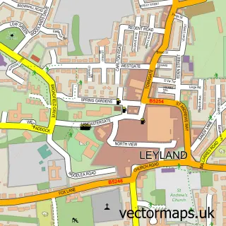
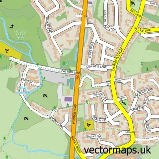
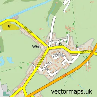
This Euxton street map is a detailed vector street map covering a 750m x 750m area. Select a larger area to create and download your own vector street map of Euxton.
The 750-metre map sample for Euxton covers 493 mapped buildings and approximately 14.0 km of road detail, of which 20 named roads are named. The immediate area includes 2 schools, 6 GP surgeries within 2 miles, 1 pub and 8 MOT stations within 2 miles. The wider area around Euxton features 2 food and drink venues. To create a larger or custom map of Euxton, the map builder lets you define your own coverage area and download editable SVG, PDF and PNG files.
Create a larger editable map of Euxton
Choose any area you need and generate a high-quality vector map instantly. Perfect for print, planning, design, business and personal use.

This Euxton street map in Lancashire is available as downloadable SVG, PDF and PNG map files, or as a printed map for planning, business, display, education, local information and design work. You can also create a larger custom map area using the map selector.
What this Euxton map sample shows
Euxton lies within Euxton Cp parish, part of Euxton South ward in the Chorley District (B) local authority area. The postcode geography for this area includes the PR postcode area, the PR7 postcode district and the PR7 6 postcode sector. Residents fall under the Nhs Lancashire And South Cumbria Integrated Care Board for NHS services.
Local features near Euxton
Within 2 milesAmenities and services in and around Euxton.
Administrative and postcode information for Euxton
The local authority covering Euxton is Chorley District (B), within the county of Lancashire. The settlement lies within Euxton South ward and Euxton Cp civil parish. The PR7 postcode district and PR7 6 postcode sector serve the immediate area. NHS provision in the area is delivered through Lancashire Teaching Hospitals Nhs Foundation Trust.
Nearby street map samples around Euxton

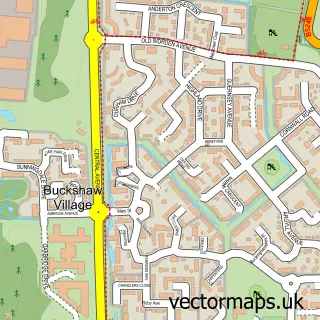
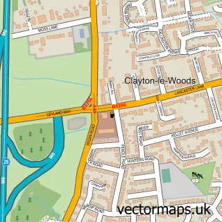
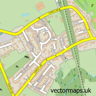
More street maps in Lancashire
750 metre map area coverage
Boundary, postcode and point of interest information for the 750m x 750m rectangle centred on this sample map.
Boundaries containing map centre
Constituency: Chorley Co Const, South Ribble Co Const
County: Lancashire County
District: Chorley District (B)
Icb: NHS Lancashire and South Cumbria ICB
Parish: Euxton CP
Police Force: lancashire
Postcode District: PR7
Postcode Sector: PR7 6
Ward: Croston, Mawdesley & Euxton South Ward
Nearby boundaries intersecting sample
Ward: Euxton Ward
Postcode coverage
POI category counts
Elementary School: 6
Dentist: 3
Furniture Store: 3
Italian Restaurant: 3
Life Insurance: 2
Professional Services: 2
Anglican Church: 1
Assisted Living Facility: 1
Automotive Dealer: 1
Building Supply Store: 1
Sample points of interest
- Euxton Parish Church
- Four Seasons Health Care Chorley, Broughton Court Care Home
- EV Heroes
- Connected Electrical Contractors North West Ltd
- Bugle Inn Motor Co
- St Mary's R C Church
- Euxton Community Centre
- Prestige School of Dancing
- Euxton Dental Centre
- mydentist
- {my}dentist
- The Euxton Medical Centre
Create a larger editable map of Euxton
This sample shows only a 750 metre area. To create a larger map of Euxton, use our map builder to choose your own coverage area, add titles and download editable SVG, PDF and PNG files.
Create a custom map of Euxton