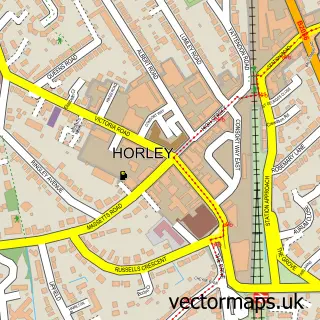
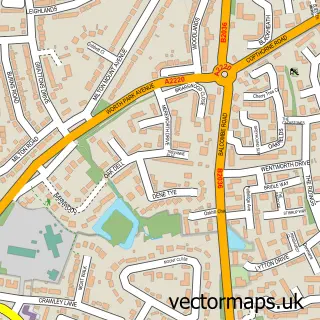
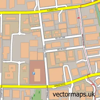
This Copthorne street map is a detailed vector street map covering a 750m x 750m area. Select a larger area to create and download your own vector street map of Copthorne.
The 750-metre map sample for Copthorne covers 553 mapped buildings and approximately 16.1 km of road detail, of which 36 named roads are named. The immediate area includes 2 schools and 12 MOT stations within 2 miles. The wider area around Copthorne features 1 food and drink venue. To create a larger or custom map of Copthorne, the map builder lets you define your own coverage area and download editable SVG, PDF and PNG files.
Create a larger editable map of Copthorne
Choose any area you need and generate a high-quality vector map instantly. Perfect for print, planning, design, business and personal use.

This Copthorne street map in West Sussex is available as downloadable SVG, PDF and PNG map files, or as a printed map for planning, business, display, education, local information and design work. You can also create a larger custom map area using the map selector.
What this Copthorne map sample shows
Copthorne lies within Worth Cp parish, part of Copthorne And Worth ward in the Mid Sussex District local authority area. The postcode geography for this area includes the RH postcode area, the RH10 postcode district and the RH10 3 postcode sector. Residents fall under the Nhs Sussex Integrated Care Board for NHS services.
Local features near Copthorne
Within 2 milesAmenities and services in and around Copthorne.
Administrative and postcode information for Copthorne
Copthorne lies within Worth Cp parish, part of Copthorne And Worth ward in the Mid Sussex District local authority area. The postcode geography for this area includes the RH postcode area, the RH10 postcode district and the RH10 3 postcode sector. Residents fall under the Nhs Sussex Integrated Care Board for NHS services.
Nearby street map samples around Copthorne

More street maps in West Sussex
750 metre map area coverage
Boundary, postcode and point of interest information for the 750m x 750m rectangle centred on this sample map.
Boundaries containing map centre
Constituency: East Grinstead and Uckfield Co Const
County: West Sussex County
District: Mid Sussex District
Icb: NHS Surrey and Sussex ICB
Parish: Worth CP
Police Force: sussex
Postcode District: RH10
Postcode Sector: RH10 3
Ward: Copthorne & Worth Ward
Nearby boundaries intersecting sample
Constituency: East Surrey Co Const
County: Surrey County
District: Tandridge District
Parish: Burstow CP
Police Force: surrey
Ward: Burstow, Horne & Outwood Ward
Postcode coverage
POI category counts
Convenience Store: 4
Professional Services: 4
Church Cathedral: 3
Electrician: 3
Flowers And Gifts Shop: 3
Hair Salon: 3
Plumbing: 3
Real Estate Agent: 3
Building Supply Store: 2
Event Planning: 2
Sample points of interest
- Springfit Gymnastics And Trampoline Club
- St. John the Evangelist
- Antique Chandeliers
- Morrisons Daily - Copthorne Kimberley House, Copthorne
- Defined barber parlour
- Images Hair & Beauty
- aesthetics by liv
- Prince Albert Pub
- Image Construction
- Goodman Electrical
- R Edgar Building Contractors
- S J Inventory Services
Create a larger editable map of Copthorne
This sample shows only a 750 metre area. To create a larger map of Copthorne, use our map builder to choose your own coverage area, add titles and download editable SVG, PDF and PNG files.
Create a custom map of Copthorne