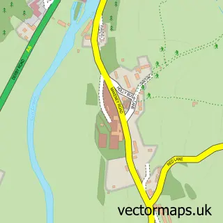
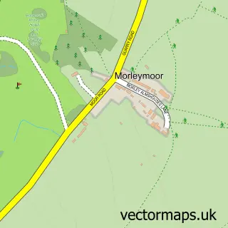
This Coxbench street map is a detailed vector street map covering a 750m x 750m area. Select a larger area to create and download your own vector street map of Coxbench.
The 750-metre map sample for Coxbench covers 87 mapped buildings and approximately 31.0 km of road detail, of which 6 named roads are named. The immediate area includes 2 GP surgeries within 2 miles, 1 pub and 8 MOT stations within 2 miles. The wider area around Coxbench features 1 food and drink venue. To create a larger or custom map of Coxbench, the map builder lets you define your own coverage area and download editable SVG, PDF and PNG files.
Create a larger editable map of Coxbench
Choose any area you need and generate a high-quality vector map instantly. Perfect for print, planning, design, business and personal use.

This Coxbench street map in Derbyshire is available as downloadable SVG, PDF and PNG map files, or as a printed map for planning, business, display, education, local information and design work. You can also create a larger custom map area using the map selector.
What this Coxbench map sample shows
Coxbench lies within Horsley Cp parish, part of Shipley Park, Horsley And Horsley Woodhouse ward in the Amber Valley District (B) local authority area. The postcode geography for this area includes the DE postcode area, the DE21 postcode district and the DE21 5 postcode sector. Residents fall under the Nhs Derby And Derbyshire Integrated Care Board for NHS services.
Local features near Coxbench
Within 2 milesAmenities and services in and around Coxbench.
Administrative and postcode information for Coxbench
The local authority covering Coxbench is Amber Valley District (B), within the county of Derbyshire. The settlement lies within Shipley Park, Horsley And Horsley Woodhouse ward and Horsley Cp civil parish. The DE21 postcode district and DE21 5 postcode sector serve the immediate area. NHS provision in the area is delivered through University Hospitals Of Derby And Burton Nhs Foundation Trust.
Nearby street map samples around Coxbench

More street maps in Derbyshire
750 metre map area coverage
Boundary, postcode and point of interest information for the 750m x 750m rectangle centred on this sample map.
Boundaries containing map centre
Constituency: Amber Valley Co Const
County: Derbyshire County
District: Amber Valley District (B)
Icb: NHS Derby and Derbyshire ICB
Parish: Horsley CP
Police Force: derbyshire
Postcode District: DE21
Postcode Sector: DE21 5
Ward: Kilburn, Denby, Holbrook & Horsley Ward
Nearby boundaries intersecting sample
Parish: Holbrook CP
Postcode coverage
POI category counts
Pet Boarding: 2
Afghan Restaurant: 1
Automotive Repair: 1
Gardener: 1
Nursing School: 1
Pub: 1
Real Estate Agent: 1
Retirement Home: 1
Train Station: 1
Sample points of interest
- Kenneth gohars Plumbing
- Manx Engines
- Hydraseeders
- Coxbench Hall Ltd.
- Treetops Boarding Kennels & Cattery
- Treetops Kennels and Cattery
- Fox & Hounds
- James Norman Estate Agents
- Coxbench Hall
- Coxbench railway station
Create a larger editable map of Coxbench
This sample shows only a 750 metre area. To create a larger map of Coxbench, use our map builder to choose your own coverage area, add titles and download editable SVG, PDF and PNG files.
Create a custom map of Coxbench