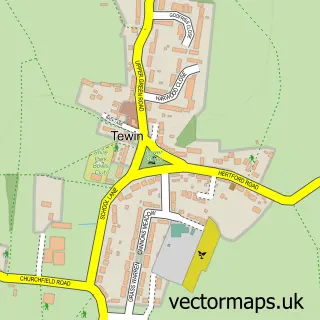
This Datchworth Green street map is a detailed vector street map covering a 750m x 750m area. Select a larger area to create and download your own vector street map of Datchworth Green.
The 750-metre map sample for Datchworth Green covers 157 mapped buildings and approximately 7.8 km of road detail, of which 13 named roads are named. The immediate area includes 1 GP surgery within 2 miles, 2 pubs and 1 MOT station within 2 miles. The wider area around Datchworth Green features 4 food and drink venues. To create a larger or custom map of Datchworth Green, the map builder lets you define your own coverage area and download editable SVG, PDF and PNG files.
Create a larger editable map of Datchworth Green
Choose any area you need and generate a high-quality vector map instantly. Perfect for print, planning, design, business and personal use.

This Datchworth Green street map in Hertfordshire is available as downloadable SVG, PDF and PNG map files, or as a printed map for planning, business, display, education, local information and design work. You can also create a larger custom map area using the map selector.
What this Datchworth Green map sample shows
Datchworth Green lies within Datchworth Cp parish, part of Datchworth & Aston ward in the East Hertfordshire District local authority area. The postcode geography for this area includes the SG postcode area, the SG3 postcode district and the SG3 6 postcode sector. Residents fall under the Nhs Hertfordshire And West Essex Integrated Care Board for NHS services.
Local features near Datchworth Green
Within 2 milesAmenities and services in and around Datchworth Green.
Administrative and postcode information for Datchworth Green
The local authority covering Datchworth Green is East Hertfordshire District, within the county of Hertfordshire. The settlement lies within Datchworth & Aston ward and Datchworth Cp civil parish. The SG3 postcode district and SG3 6 postcode sector serve the immediate area. NHS provision in the area is delivered through East And North Hertfordshire Nhs Trust.
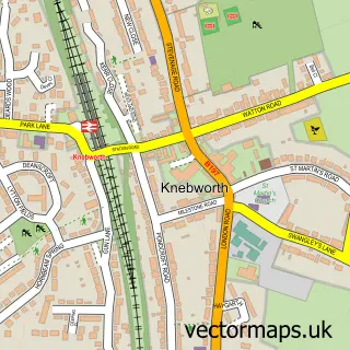
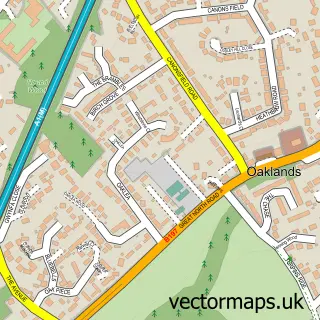
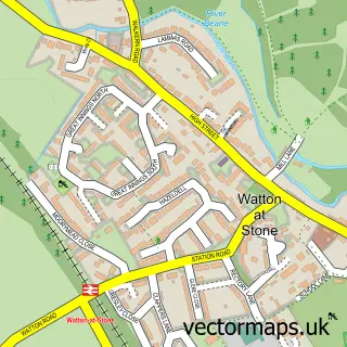
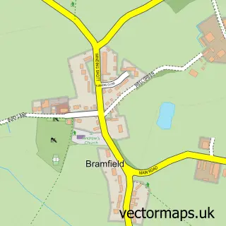
Nearby street map samples around Datchworth Green

More street maps in Hertfordshire
750 metre map area coverage
Boundary, postcode and point of interest information for the 750m x 750m rectangle centred on this sample map.
Boundaries containing map centre
Constituency: Stevenage Co Const
County: Hertfordshire County
District: East Hertfordshire District
Icb: NHS Central East ICB
Parish: Datchworth CP
Police Force: hertfordshire
Postcode District: SG3
Postcode Sector: SG3 6
Ward: Aston, Datchworth & Walkern Ward
Nearby boundaries intersecting sample
Constituency: North East Hertfordshire Co Const
Parish: Watton-at-Stone CP
Postcode District: SG14
Postcode Sector: SG14 2
Ward: Watton-at-Stone Ward
Postcode coverage
POI category counts
Coffee Shop: 2
Martial Arts Club: 2
Playground: 2
Post Office: 2
Pub: 2
Sports Club And League: 2
Beauty Salon: 1
Caterer: 1
Community Center: 1
Community Services Non Profits: 1
Sample points of interest
- Beauty by Belleza
- Bain & Bridges Catering
- Datchworth Coffee
- Datchworth Coffee
- Datchworth Village Hall
- Stevenage & District Model Railway Club
- Contract Surfacing
- Endo Mishra the Root Canal Specialist
- Datchworth Dog Walks
- B.J.M School of Motoring
- Ixia Floral Designs
- Pesttech
Create a larger editable map of Datchworth Green
This sample shows only a 750 metre area. To create a larger map of Datchworth Green, use our map builder to choose your own coverage area, add titles and download editable SVG, PDF and PNG files.
Create a custom map of Datchworth Green