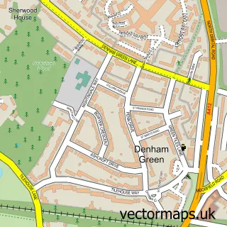
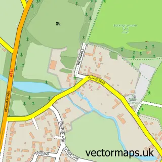
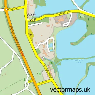
This Denham Garden Village street map is a detailed vector street map covering a 750m x 750m area. Select a larger area to create and download your own vector street map of Denham Garden Village.
The 750-metre map sample for Denham Garden Village covers 248 mapped buildings and approximately 11.5 km of road detail, of which 20 named roads are named. The immediate area includes 1 school, 1 GP surgery, with 2 within 2 miles and 5 MOT stations within 2 miles. The wider area around Denham Garden Village features 1 food and drink venue and 3 hotels. To create a larger or custom map of Denham Garden Village, the map builder lets you define your own coverage area and download editable SVG, PDF and PNG files.
Create a larger editable map of Denham Garden Village
Choose any area you need and generate a high-quality vector map instantly. Perfect for print, planning, design, business and personal use.

This Denham Garden Village street map in Buckinghamshire is available as downloadable SVG, PDF and PNG map files, or as a printed map for planning, business, display, education, local information and design work. You can also create a larger custom map area using the map selector.
What this Denham Garden Village map sample shows
Denham Garden Village lies within Denham Cp parish, part of Denham ward in the Buckinghamshire local authority area. The postcode geography for this area includes the UB postcode area, the UB9 postcode district and the UB9 5 postcode sector. Residents fall under the Nhs Buckinghamshire, Oxfordshire And Berkshire West Integrated Care Board for NHS services.
Local features near Denham Garden Village
Within 2 milesAmenities and services in and around Denham Garden Village.
Administrative and postcode information for Denham Garden Village
The local authority covering Denham Garden Village is Buckinghamshire, within the county of Buckinghamshire. The settlement lies within Denham ward and Denham Cp civil parish. The UB9 postcode district and UB9 5 postcode sector serve the immediate area. NHS provision in the area is delivered through Frimley Health Nhs Foundation Trust.
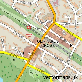
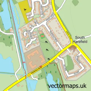
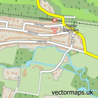
Nearby street map samples around Denham Garden Village

More street maps in Buckinghamshire
750 metre map area coverage
Boundary, postcode and point of interest information for the 750m x 750m rectangle centred on this sample map.
Boundaries containing map centre
Constituency: Beaconsfield Co Const
District: Buckinghamshire
Icb: NHS Thames Valley ICB
Parish: Denham CP
Police Force: thames valley
Postcode District: UB9
Postcode Sector: UB9 5
Ward: Gerrards Cross & Denham Ward
Nearby boundaries intersecting sample
Constituency: Uxbridge and South Ruislip Boro Const
County: Greater London Authority
District: Hillingdon London Boro
Ward: Ickenham & South Harefield Ward
Postcode coverage
POI category counts
Retirement Home: 4
Doctor: 3
Hotel: 3
Movie Television Studio: 3
Assisted Living Facility: 2
Gym: 2
Alternative Medicine: 1
Anglican Church: 1
Atms: 1
Automotive: 1
Sample points of interest
- Denham Osteopathy & Sports Injury Clinic
- Denham Green: St Mark's Hall
- Anchor - Denham Garden Village
- Poppy Cottage
- ANCHOR TRUST
- IHG Global Headquarters and Europe Office
- Varta Automotive Batteries
- Lashes, Brows & Beauty By Jordan
- JC Plumbing Services
- Chiltern Private
- Denham Medical Centre
- Denham Medical Centre
Create a larger editable map of Denham Garden Village
This sample shows only a 750 metre area. To create a larger map of Denham Garden Village, use our map builder to choose your own coverage area, add titles and download editable SVG, PDF and PNG files.
Create a custom map of Denham Garden Village