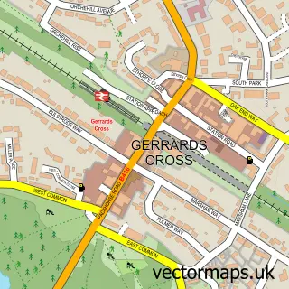
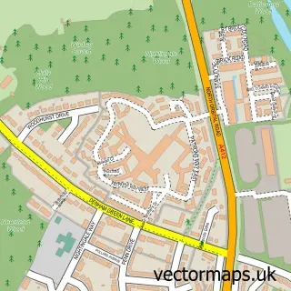
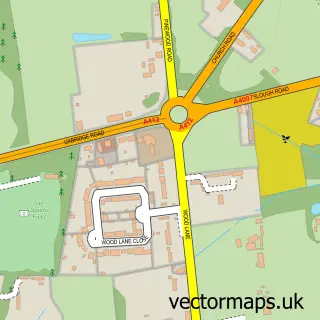
This Tatling End street map is a detailed vector street map covering a 750m x 750m area. Select a larger area to create and download your own vector street map of Tatling End.
The 750-metre map sample for Tatling End covers 104 mapped buildings and approximately 13.5 km of road detail, of which 8 named roads are named. The immediate area includes 1 GP surgery within 2 miles and 1 MOT station, with 2 within 2 miles. The wider area around Tatling End features 1 food and drink venue. To create a larger or custom map of Tatling End, the map builder lets you define your own coverage area and download editable SVG, PDF and PNG files.
Create a larger editable map of Tatling End
Choose any area you need and generate a high-quality vector map instantly. Perfect for print, planning, design, business and personal use.

This Tatling End street map in Buckinghamshire is available as downloadable SVG, PDF and PNG map files, or as a printed map for planning, business, display, education, local information and design work. You can also create a larger custom map area using the map selector.
What this Tatling End map sample shows
Tatling End lies within Gerrards Cross Cp parish, part of Gerrards Cross ward in the Buckinghamshire local authority area. The postcode geography for this area includes the SL postcode area, the SL9 postcode district and the SL9 7 postcode sector. Residents fall under the Nhs Buckinghamshire, Oxfordshire And Berkshire West Integrated Care Board for NHS services.
Local features near Tatling End
Within 2 milesAmenities and services in and around Tatling End.
Administrative and postcode information for Tatling End
The local authority covering Tatling End is Buckinghamshire, within the county of Buckinghamshire. The settlement lies within Gerrards Cross ward and Gerrards Cross Cp civil parish. The SL9 postcode district and SL9 7 postcode sector serve the immediate area. NHS provision in the area is delivered through Frimley Health Nhs Foundation Trust.
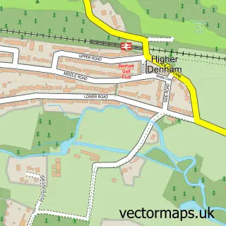
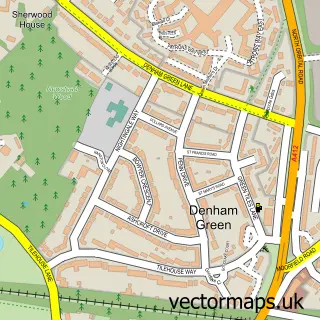
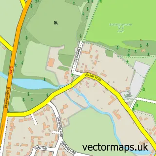
Nearby street map samples around Tatling End

More street maps in Buckinghamshire
750 metre map area coverage
Boundary, postcode and point of interest information for the 750m x 750m rectangle centred on this sample map.
Boundaries containing map centre
Constituency: Beaconsfield Co Const
District: Buckinghamshire
Icb: NHS Thames Valley ICB
Parish: Denham CP
Police Force: thames valley
Postcode District: SL9
Postcode Sector: SL9 7
Ward: Gerrards Cross & Denham Ward
Nearby boundaries intersecting sample
Constituency: Chesham and Amersham Co Const
Parish: Fulmer CP, Gerrards Cross CP
Postcode District: UB9
Postcode Sector: UB9 4
Ward: Farnhams & Stoke Poges Ward
Postcode coverage
POI category counts
Automotive: 3
Building Supply Store: 3
Auto Detailing: 2
Building Contractor: 2
Contractor: 2
Metal Fabricator: 2
Professional Services: 2
Roofing: 2
Advertising Agency: 1
Automotive Repair: 1
Sample points of interest
- Y F R
- Aron Car Valeting LTD
- Top Car Valet
- Endeavour Approved
- Endeavour INEOS Grenadier Gerrards Cross
- Volvo Cars Gerrards Cross
- Bulstrode Garage of Gerrards Cross
- Indigo bar and grill
- Toby Carvery
- David Bailey Designs
- Foundations Masters and Block Paving
- Estimus Ltd
Create a larger editable map of Tatling End
This sample shows only a 750 metre area. To create a larger map of Tatling End, use our map builder to choose your own coverage area, add titles and download editable SVG, PDF and PNG files.
Create a custom map of Tatling End