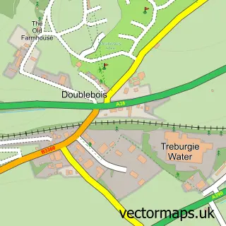
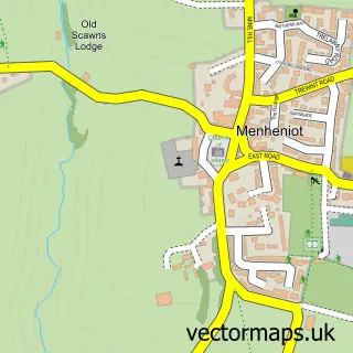
This Dobwalls street map is a detailed vector street map covering a 750m x 750m area. Select a larger area to create and download your own vector street map of Dobwalls.
The 750-metre map sample for Dobwalls covers 319 mapped buildings and approximately 16.4 km of road detail, of which 25 named roads are named. The immediate area includes 1 school, 1 pub and 1 MOT station, with 6 within 2 miles. The wider area around Dobwalls features 3 food and drink venues and 1 campsite within 2 miles. To create a larger or custom map of Dobwalls, the map builder lets you define your own coverage area and download editable SVG, PDF and PNG files.
Create a larger editable map of Dobwalls
Choose any area you need and generate a high-quality vector map instantly. Perfect for print, planning, design, business and personal use.

This Dobwalls street map in Cornwall is available as downloadable SVG, PDF and PNG map files, or as a printed map for planning, business, display, education, local information and design work. You can also create a larger custom map area using the map selector.
What this Dobwalls map sample shows
Dobwalls lies within Dobwalls Cp parish, part of Liskeard West And Dobwalls ward in the Cornwall local authority area. The postcode geography for this area includes the PL postcode area, the PL14 postcode district and the PL14 6 postcode sector. Residents fall under the Nhs Cornwall And The Isles Of Scilly Integrated Care Board for NHS services.
Local features near Dobwalls
Within 2 milesAmenities and services in and around Dobwalls.
Administrative and postcode information for Dobwalls
Dobwalls lies within Dobwalls Cp parish, part of Liskeard West And Dobwalls ward in the Cornwall local authority area. The postcode geography for this area includes the PL postcode area, the PL14 postcode district and the PL14 6 postcode sector. Residents fall under the Nhs Cornwall And The Isles Of Scilly Integrated Care Board for NHS services.
Nearby street map samples around Dobwalls

More street maps in Cornwall
750 metre map area coverage
Boundary, postcode and point of interest information for the 750m x 750m rectangle centred on this sample map.
Boundaries containing map centre
Constituency: South East Cornwall Co Const
District: Cornwall
Icb: NHS Cornwall and the Isles of Scilly ICB
Parish: Dobwalls CP
Police Force: devon and cornwall
Postcode District: PL14
Postcode Sector: PL14 6
Nearby boundaries intersecting sample
Postcode Sector: PL14 4
Postcode coverage
POI category counts
Carpet Cleaning: 2
Hair Salon: 2
Pet Groomer: 2
Recycling Center: 2
Shipping Center: 2
Acupuncture: 1
Antique Store: 1
Art Gallery: 1
Car Dealer: 1
Church Cathedral: 1
Sample points of interest
- Melissa Shapland Acupuncture
- Olden Days Antiques & Restoration
- Southern Gallery
- Rowes Honda
- Home N Dry
- Home N Dry - Carpet Cleaning Liskeard
- Dobwalls United Church
- Costa Express
- Dobwalls Memorial Hall
- Watermill Kitchens
- Spar
- Evri ParcelShop
Create a larger editable map of Dobwalls
This sample shows only a 750 metre area. To create a larger map of Dobwalls, use our map builder to choose your own coverage area, add titles and download editable SVG, PDF and PNG files.
Create a custom map of Dobwalls