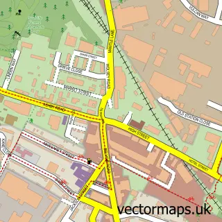
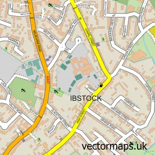
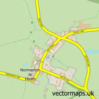
This Donington Le Heath street map is a detailed vector street map covering a 750m x 750m area. Select a larger area to create and download your own vector street map of Donington Le Heath.
The 750-metre map sample for Donington Le Heath covers 252 mapped buildings and approximately 14.5 km of road detail, of which 19 named roads are named. The immediate area includes 5 GP surgeries within 2 miles, 1 pub and 12 MOT stations within 2 miles. The wider area around Donington Le Heath features 3 tourism points of interest, 1 food and drink venue and 1 campsite within 2 miles. To create a larger or custom map of Donington Le Heath, the map builder lets you define your own coverage area and download editable SVG, PDF and PNG files.
Create a larger editable map of Donington Le Heath
Choose any area you need and generate a high-quality vector map instantly. Perfect for print, planning, design, business and personal use.

This Donington Le Heath street map in Leicestershire is available as downloadable SVG, PDF and PNG map files, or as a printed map for planning, business, display, education, local information and design work. You can also create a larger custom map area using the map selector.
What this Donington Le Heath map sample shows
Donington Le Heath lies within Hugglescote And Donington Le Heath Cp parish, part of Hugglescote St Mary's ward in the North West Leicestershire District local authority area. The postcode geography for this area includes the LE postcode area, the LE67 postcode district and the LE67 3 postcode sector. Residents fall under the Nhs Leicester, Leicestershire And Rutland Integrated Care Board for NHS services.
Local features near Donington Le Heath
Within 2 milesAmenities and services in and around Donington Le Heath.
Administrative and postcode information for Donington Le Heath
The local authority covering Donington Le Heath is North West Leicestershire District, within the county of Leicestershire. The settlement lies within Hugglescote St Mary's ward and Hugglescote And Donington Le Heath Cp civil parish. The LE67 postcode district and LE67 3 postcode sector serve the immediate area. NHS provision in the area is delivered through University Hospitals Of Leicester Nhs Trust.
Nearby street map samples around Donington Le Heath

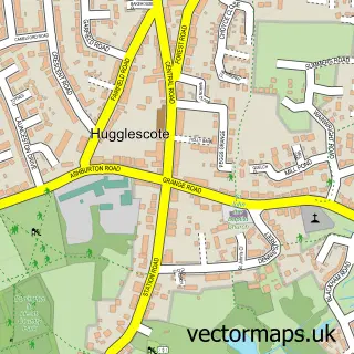
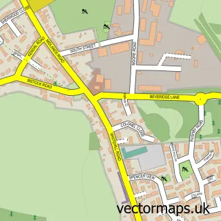
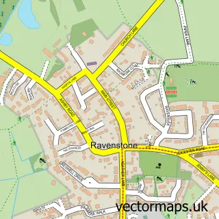
More street maps in Leicestershire
750 metre map area coverage
Boundary, postcode and point of interest information for the 750m x 750m rectangle centred on this sample map.
Boundaries containing map centre
Constituency: North West Leicestershire Co Const
County: Leicestershire County
District: North West Leicestershire District
Icb: NHS Leicester Leicestershire and Rutland ICB
Parish: Hugglescote and Donington le Heath CP
Police Force: leicestershire
Postcode District: LE67
Postcode Sector: LE67 2
Ward: Hugglescote St. John's Ward
Nearby boundaries intersecting sample
Parish: Ellistown and Battleflat CP
Postcode Sector: LE67 1
Ward: Ellistown & Battleflat Ward, Hugglescote St. Mary's Ward
Postcode coverage
POI category counts
Event Photography: 2
History Museum: 2
Architectural Designer: 1
Bar: 1
Career Counseling: 1
Education: 1
Electrician: 1
Engineering Services: 1
Gardener: 1
Grocery Store: 1
Sample points of interest
- DS Architectural Ltd
- The Corner Pin
- Donington Personal Effectiveness Training Services
- Gill Blenco Educational
- JE Electrical & Mechanical Services
- Elite Heating Solutions
- Halo Sound and Vision
- Livi Gee photography
- Manor Landscapes
- The Co-operative Food
- My Skinfood
- 1620s House & Garden at Donington le Heath, Leicestershire, UK
Create a larger editable map of Donington Le Heath
This sample shows only a 750 metre area. To create a larger map of Donington Le Heath, use our map builder to choose your own coverage area, add titles and download editable SVG, PDF and PNG files.
Create a custom map of Donington Le Heath