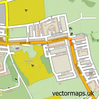
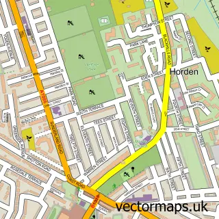
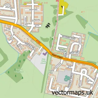
This Easington street map is a detailed vector street map covering a 750m x 750m area. Select a larger area to create and download your own vector street map of Easington.
The 750-metre map sample for Easington covers 351 mapped buildings and approximately 14.9 km of road detail, of which 29 named roads are named. The immediate area includes 2 schools, 2 pubs and 6 MOT stations within 2 miles. The wider area around Easington features 1 tourism point of interest and 4 food and drink venues. To create a larger or custom map of Easington, the map builder lets you define your own coverage area and download editable SVG, PDF and PNG files.
Create a larger editable map of Easington
Choose any area you need and generate a high-quality vector map instantly. Perfect for print, planning, design, business and personal use.

This Easington street map in Durham is available as downloadable SVG, PDF and PNG map files, or as a printed map for planning, business, display, education, local information and design work. You can also create a larger custom map area using the map selector.
What this Easington map sample shows
Easington lies within Easington Village Cp parish, part of Easington ward in the County Durham local authority area. The postcode geography for this area includes the SR postcode area, the SR8 postcode district and the SR8 3 postcode sector. Residents fall under the Nhs North East And North Cumbria Integrated Care Board for NHS services.
Local features near Easington
Within 2 milesAmenities and services in and around Easington.
Administrative and postcode information for Easington
Easington lies within Easington Village Cp parish, part of Easington ward in the County Durham local authority area. The postcode geography for this area includes the SR postcode area, the SR8 postcode district and the SR8 3 postcode sector. Residents fall under the Nhs North East And North Cumbria Integrated Care Board for NHS services.
Nearby street map samples around Easington

More street maps in Durham
750 metre map area coverage
Boundary, postcode and point of interest information for the 750m x 750m rectangle centred on this sample map.
Boundaries containing map centre
Constituency: Easington Co Const
District: County Durham
Icb: NHS North East and North Cumbria ICB
Parish: Easington Village CP
Police Force: durham
Postcode District: SR8
Postcode Sector: SR8 3
Nearby boundaries intersecting sample
No additional intersecting boundaries found.
Postcode coverage
POI category counts
Convenience Store: 5
Beauty Salon: 4
Post Office: 3
Coffee Shop: 2
Hair Salon: 2
Pub: 2
Tattoo And Piercing: 2
Anglican Church: 1
Atms: 1
Bar: 1
Sample points of interest
- St Mary's Church
- ATM (Post Office)
- Shoulder of Mutton
- BASE Barbershop
- North East Cosmetics
- Sakura Aesthetics
- The Beauty Nook
- The Village Retreat
- Gardens of Grace Landscapes Limited
- Quatra Solutions
- St Marys CHURCH, Easington
- St Mary’s Church Hall Easington Village Cinema
Create a larger editable map of Easington
This sample shows only a 750 metre area. To create a larger map of Easington, use our map builder to choose your own coverage area, add titles and download editable SVG, PDF and PNG files.
Create a custom map of Easington