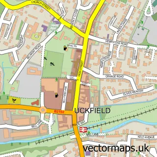
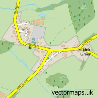
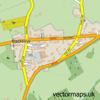
This East Hoathly street map is a detailed vector street map covering a 750m x 750m area. Select a larger area to create and download your own vector street map of East Hoathly.
The 750-metre map sample for East Hoathly covers 272 mapped buildings and approximately 11.7 km of road detail, of which 18 named roads are named. The immediate area includes 1 school, 2 pubs and 2 MOT stations within 2 miles. The wider area around East Hoathly features 1 tourism point of interest, 3 food and drink venues and 1 hotel. To create a larger or custom map of East Hoathly, the map builder lets you define your own coverage area and download editable SVG, PDF and PNG files.
Create a larger editable map of East Hoathly
Choose any area you need and generate a high-quality vector map instantly. Perfect for print, planning, design, business and personal use.

This East Hoathly street map in East Sussex is available as downloadable SVG, PDF and PNG map files, or as a printed map for planning, business, display, education, local information and design work. You can also create a larger custom map area using the map selector.
What this East Hoathly map sample shows
East Hoathly lies within East Hoathly With Halland Cp parish, part of Chiddingly, East Hoathly & Waldron ward in the Wealden District local authority area. The postcode geography for this area includes the BN postcode area, the BN8 postcode district and the BN8 6 postcode sector. Residents fall under the Nhs Sussex Integrated Care Board for NHS services.
Local features near East Hoathly
Within 2 milesAmenities and services in and around East Hoathly.
Administrative and postcode information for East Hoathly
East Hoathly lies within East Hoathly With Halland Cp parish, part of Chiddingly, East Hoathly & Waldron ward in the Wealden District local authority area. The postcode geography for this area includes the BN postcode area, the BN8 postcode district and the BN8 6 postcode sector. Residents fall under the Nhs Sussex Integrated Care Board for NHS services.
Nearby street map samples around East Hoathly

More street maps in East Sussex
750 metre map area coverage
Boundary, postcode and point of interest information for the 750m x 750m rectangle centred on this sample map.
Boundaries containing map centre
Constituency: Sussex Weald Co Const
County: East Sussex County
District: Wealden District
Icb: NHS Surrey and Sussex ICB
Parish: East Hoathly with Halland CP
Police Force: sussex
Postcode District: BN8
Postcode Sector: BN8 6
Ward: Chiddingly, East Hoathly & Waldron Ward
Nearby boundaries intersecting sample
No additional intersecting boundaries found.
Postcode coverage
POI category counts
Assisted Living Facility: 2
Bookstore: 2
Professional Services: 2
Pub: 2
Accountant: 1
Active Life: 1
Agricultural Service: 1
Anglican Church: 1
Automotive Services And Repair: 1
Beverage Supplier: 1
Sample points of interest
- Oreka Accounting
- Freedom Leisure
- FD Farming
- East Hoathly Parish Church
- Barchester - Lydfords Care Home
- Lydfords Care Home
- Beech Executive Car Hire
- The 1648 Brewing Co.
- Post Office-East Hoathly
- Clara's
- Claras Books
- Love Baby Swim School Ltd.
Create a larger editable map of East Hoathly
This sample shows only a 750 metre area. To create a larger map of East Hoathly, use our map builder to choose your own coverage area, add titles and download editable SVG, PDF and PNG files.
Create a custom map of East Hoathly