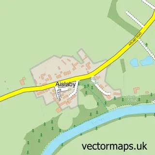
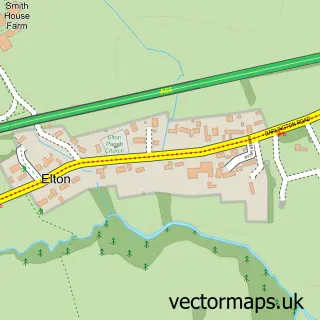
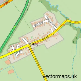
This Egglescliffe street map is a detailed vector street map covering a 750m x 750m area. Select a larger area to create and download your own vector street map of Egglescliffe.
The 750-metre map sample for Egglescliffe covers 478 mapped buildings and approximately 18.0 km of road detail, of which 39 named roads are named. The immediate area includes 2 schools, 2 GP surgeries within 2 miles, 2 pubs and 7 MOT stations within 2 miles. The wider area around Egglescliffe features 4 food and drink venues, 1 hotel and 1 campsite within 2 miles. To create a larger or custom map of Egglescliffe, the map builder lets you define your own coverage area and download editable SVG, PDF and PNG files.
Create a larger editable map of Egglescliffe
Choose any area you need and generate a high-quality vector map instantly. Perfect for print, planning, design, business and personal use.

This Egglescliffe street map in Durham is available as downloadable SVG, PDF and PNG map files, or as a printed map for planning, business, display, education, local information and design work. You can also create a larger custom map area using the map selector.
What this Egglescliffe map sample shows
Egglescliffe lies within Egglescliffe Cp parish, part of Eaglescliffe ward in the Stockton-On-Tees (B) local authority area. The postcode geography for this area includes the TS postcode area, the TS16 postcode district and the TS16 0 postcode sector. Residents fall under the Nhs North East And North Cumbria Integrated Care Board for NHS services.
Local features near Egglescliffe
Within 2 milesAmenities and services in and around Egglescliffe.
Administrative and postcode information for Egglescliffe
The local authority covering Egglescliffe is Stockton-On-Tees (B), within the county of Durham. The settlement lies within Eaglescliffe ward and Egglescliffe Cp civil parish. The TS16 postcode district and TS16 0 postcode sector serve the immediate area. NHS provision in the area is delivered through North Tees And Hartlepool Nhs Foundation Trust.
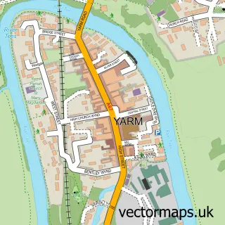
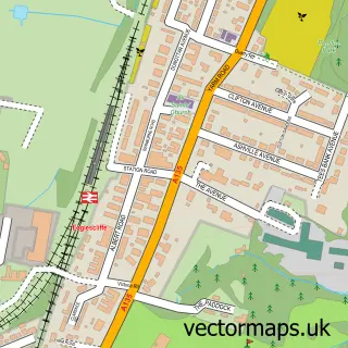
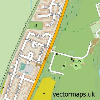
Nearby street map samples around Egglescliffe

More street maps in Durham
750 metre map area coverage
Boundary, postcode and point of interest information for the 750m x 750m rectangle centred on this sample map.
Boundaries containing map centre
Constituency: Stockton West Co Const
District: Stockton-on-Tees (B)
Icb: NHS North East and North Cumbria ICB
Parish: Egglescliffe CP
Police Force: cleveland
Postcode District: TS16
Postcode Sector: TS16 0
Ward: Eaglescliffe West Ward
Nearby boundaries intersecting sample
Ward: Eaglescliffe East Ward
Postcode coverage
POI category counts
Scout Hall: 4
Hair Salon: 3
Supermarket: 3
Barber: 2
Beauty Salon: 2
Business Manufacturing And Supply: 2
Elementary School: 2
Photo Booth Rental: 2
Preschool: 2
Professional Services: 2
Sample points of interest
- Pixie Pots Ltd
- Prestige Styling
- Eaglescliffe
- Barclays Local
- Trim Fadey
- Wicks Barbershop
- Jack Wicks Barbershop
- Beau Belle
- H Nails and Beauty
- RWF Management Services
- Assured Gaming Limited
- Eaglescliffe Pure Pallets
Create a larger editable map of Egglescliffe
This sample shows only a 750 metre area. To create a larger map of Egglescliffe, use our map builder to choose your own coverage area, add titles and download editable SVG, PDF and PNG files.
Create a custom map of Egglescliffe