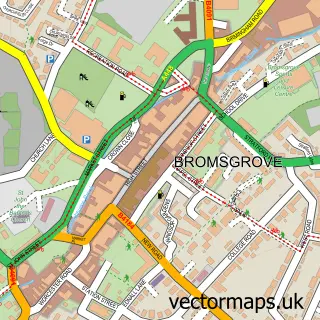
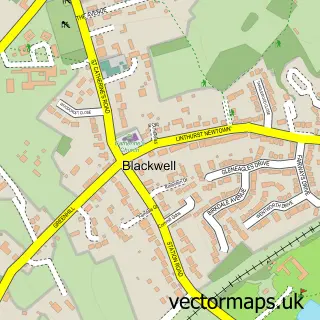
This Finstall street map is a detailed vector street map covering a 750m x 750m area. Select a larger area to create and download your own vector street map of Finstall.
The 750-metre map sample for Finstall covers 222 mapped buildings and approximately 63.3 km of road detail, of which 14 named roads are named. The immediate area includes 4 GP surgeries within 2 miles, 1 pub and 11 MOT stations within 2 miles. The wider area around Finstall features 1 food and drink venue. To create a larger or custom map of Finstall, the map builder lets you define your own coverage area and download editable SVG, PDF and PNG files.
Create a larger editable map of Finstall
Choose any area you need and generate a high-quality vector map instantly. Perfect for print, planning, design, business and personal use.

This Finstall street map in Worcestershire is available as downloadable SVG, PDF and PNG map files, or as a printed map for planning, business, display, education, local information and design work. You can also create a larger custom map area using the map selector.
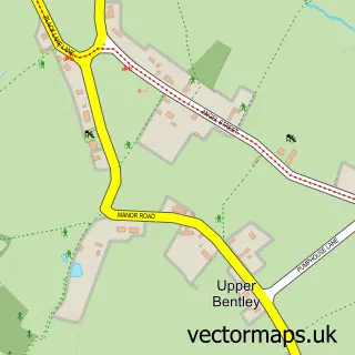
What this Finstall map sample shows
Finstall lies within Tutnall And Cobley Cp parish, part of Tardebigge ward in the Bromsgrove District local authority area. The postcode geography for this area includes the B postcode area, the B60 postcode district and the B60 3 postcode sector. Residents fall under the Nhs Herefordshire And Worcestershire Integrated Care Board for NHS services.
Local features near Finstall
Within 2 milesAmenities and services in and around Finstall.
Administrative and postcode information for Finstall
Finstall lies within Tutnall And Cobley Cp parish, part of Tardebigge ward in the Bromsgrove District local authority area. The postcode geography for this area includes the B postcode area, the B60 postcode district and the B60 3 postcode sector. Residents fall under the Nhs Herefordshire And Worcestershire Integrated Care Board for NHS services.
Nearby street map samples around Finstall

More street maps in Worcestershire
750 metre map area coverage
Boundary, postcode and point of interest information for the 750m x 750m rectangle centred on this sample map.
Boundaries containing map centre
Constituency: Bromsgrove Co Const
County: Worcestershire County
District: Bromsgrove District
Icb: NHS Herefordshire and Worcestershire ICB
Parish: Finstall CP
Police Force: west mercia
Postcode District: B60
Postcode Sector: B60 3
Ward: Tardebigge Ward
Nearby boundaries intersecting sample
Parish: Tutnall and Cobley CP
Postcode Sector: B60 1, B60 2
Ward: Aston Fields Ward, Slideslow Ward
Postcode coverage
POI category counts
Construction Services: 2
Scout Hall: 2
Boxing Class: 1
Building Supply Store: 1
Clothing Store: 1
Community Center: 1
Driving Range: 1
Environmental Testing: 1
Flooring Contractors: 1
Furniture Store: 1
Sample points of interest
- Calibre Boxing Redditch & Bromsgrove
- Bromsgrove Windows & Conservatories
- Pablo & Silva Limited
- Finstall Village Hall
- Alan Ward Builders
- Central Concrete Pumping
- Bromsgrove Golf Academy
- Essential Ecology
- Central Flow Screed & Underfloor Heating Ltd.
- Jackie Cater Soft Furnishings
- Marsia Hair & Glamour
- Secure Gates
Create a larger editable map of Finstall
This sample shows only a 750 metre area. To create a larger map of Finstall, use our map builder to choose your own coverage area, add titles and download editable SVG, PDF and PNG files.
Create a custom map of Finstall