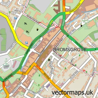
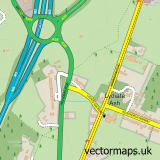
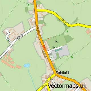
This Lickey End street map is a detailed vector street map covering a 750m x 750m area. Select a larger area to create and download your own vector street map of Lickey End.
The 750-metre map sample for Lickey End covers 318 mapped buildings and approximately 55.9 km of road detail, of which 24 named roads are named. The immediate area includes 1 school, 5 GP surgeries within 2 miles, 1 pub and 10 MOT stations within 2 miles. The wider area around Lickey End features 1 food and drink venue. To create a larger or custom map of Lickey End, the map builder lets you define your own coverage area and download editable SVG, PDF and PNG files.
Create a larger editable map of Lickey End
Choose any area you need and generate a high-quality vector map instantly. Perfect for print, planning, design, business and personal use.

This Lickey End street map in Worcestershire is available as downloadable SVG, PDF and PNG map files, or as a printed map for planning, business, display, education, local information and design work. You can also create a larger custom map area using the map selector.
What this Lickey End map sample shows
Lickey End lies within Worcestershire County parish, part of Norton ward in the Bromsgrove District local authority area. The postcode geography for this area includes the B postcode area, the B60 postcode district and the B60 1 postcode sector. Residents fall under the Nhs Herefordshire And Worcestershire Integrated Care Board for NHS services.
Local features near Lickey End
Within 2 milesAmenities and services in and around Lickey End.
Administrative and postcode information for Lickey End
Lickey End lies within Worcestershire County parish, part of Norton ward in the Bromsgrove District local authority area. The postcode geography for this area includes the B postcode area, the B60 postcode district and the B60 1 postcode sector. Residents fall under the Nhs Herefordshire And Worcestershire Integrated Care Board for NHS services.
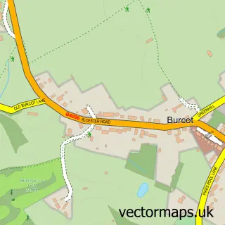
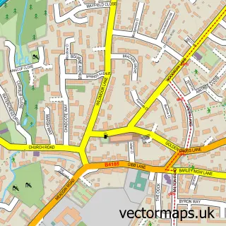
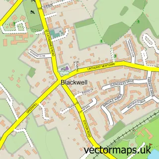
Nearby street map samples around Lickey End

More street maps in Worcestershire
750 metre map area coverage
Boundary, postcode and point of interest information for the 750m x 750m rectangle centred on this sample map.
Boundaries containing map centre
Constituency: Bromsgrove Co Const
County: Worcestershire County
District: Bromsgrove District
Icb: NHS Herefordshire and Worcestershire ICB
Police Force: west mercia
Postcode District: B60
Postcode Sector: B60 1
Ward: Norton Ward
Nearby boundaries intersecting sample
Postcode District: B61
Postcode Sector: B61 0
Ward: Catshill South Ward, Lowes Hill Ward, Marlbrook Ward
Postcode coverage
POI category counts
Convenience Store: 9
Building Supply Store: 3
Gas Station: 3
Elementary School: 2
Hair Salon: 2
Preschool: 2
Web Designer: 2
Active Life: 1
Advertising Agency: 1
Ambulance And Ems Services: 1
Sample points of interest
- Athletic Performance Training
- Clubbish
- Bromsgrove Ambulance Hub
- China Mend
- Belleame lashes
- The Forest (Harvester)
- Adapt Flooring
- Clover Gardening Services
- MJC Electrical Contractors
- Junction One Church
- British Red Cross
- Oakley Computer Training
Create a larger editable map of Lickey End
This sample shows only a 750 metre area. To create a larger map of Lickey End, use our map builder to choose your own coverage area, add titles and download editable SVG, PDF and PNG files.
Create a custom map of Lickey End