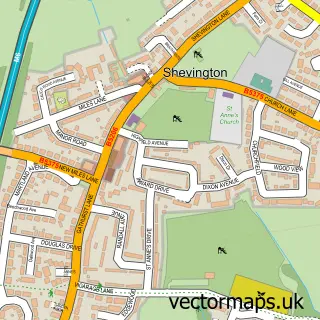
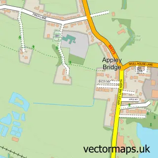
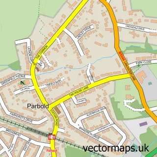
This Gathurst street map is a detailed vector street map covering a 750m x 750m area. Select a larger area to create and download your own vector street map of Gathurst.
The 750-metre map sample for Gathurst covers 100 mapped buildings and approximately 10.9 km of road detail, of which 8 named roads are named. The immediate area includes 1 railway station, 3 GP surgeries within 2 miles, 1 pub and 10 MOT stations within 2 miles. The wider area around Gathurst features 1 food and drink venue. To create a larger or custom map of Gathurst, the map builder lets you define your own coverage area and download editable SVG, PDF and PNG files.
Create a larger editable map of Gathurst
Choose any area you need and generate a high-quality vector map instantly. Perfect for print, planning, design, business and personal use.

This Gathurst street map in Greater Manchester is available as downloadable SVG, PDF and PNG map files, or as a printed map for planning, business, display, education, local information and design work. You can also create a larger custom map area using the map selector.
What this Gathurst map sample shows
Gathurst lies within Wigan District (B) parish, part of Pemberton ward in the Wigan District (B) local authority area. The postcode geography for this area includes the WN postcode area, the WN5 postcode district and the WN5 0 postcode sector. Residents fall under the Nhs Greater Manchester Integrated Care Board for NHS services.
Local features near Gathurst
Within 2 milesAmenities and services in and around Gathurst.
Administrative and postcode information for Gathurst
Gathurst lies within Wigan District (B) parish, part of Pemberton ward in the Wigan District (B) local authority area. The postcode geography for this area includes the WN postcode area, the WN5 postcode district and the WN5 0 postcode sector. Residents fall under the Nhs Greater Manchester Integrated Care Board for NHS services.
Nearby street map samples around Gathurst
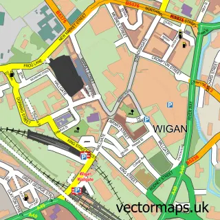

More street maps in Greater Manchester
750 metre map area coverage
Boundary, postcode and point of interest information for the 750m x 750m rectangle centred on this sample map.
Boundaries containing map centre
Constituency: Wigan Co Const
District: Wigan District (B)
Icb: NHS Greater Manchester ICB
Parish: Shevington CP
Police Force: greater manchester
Postcode District: WN6
Postcode Sector: WN6 8
Ward: Shevington with Lower Ground & Moor Ward
Nearby boundaries intersecting sample
Constituency: Makerfield Boro Const
Postcode District: WN5
Postcode Sector: WN5 0, WN5 8
Ward: Orrell Ward, Pemberton Ward
Postcode coverage
POI category counts
Train Station: 2
Accommodation: 1
Contractor: 1
Health And Medical: 1
Horse Riding: 1
Package Locker: 1
Pet Sitting: 1
Pub: 1
Tea Room: 1
Sample points of interest
- Gathurst Hall
- S J Collier Construction
- Inglewood Healing Centre
- Deandane Riding Stables
- InPost
- Deandane Kennels & Cattery
- Gathurst Station Inn
- The Narrowboat Tearoom
- Gathurst
- Gathurst railway station
Create a larger editable map of Gathurst
This sample shows only a 750 metre area. To create a larger map of Gathurst, use our map builder to choose your own coverage area, add titles and download editable SVG, PDF and PNG files.
Create a custom map of Gathurst