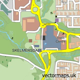
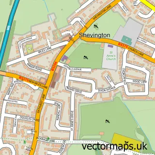
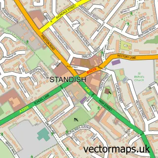
This Upholland street map is a detailed vector street map covering a 750m x 750m area. Select a larger area to create and download your own vector street map of Upholland.
The 750-metre map sample for Upholland covers 348 mapped buildings and approximately 15.4 km of road detail, of which 35 named roads are named. The immediate area includes 4 GP surgeries within 2 miles, 3 pubs and 1 MOT station, with 6 within 2 miles. The wider area around Upholland features 5 food and drink venues. To create a larger or custom map of Upholland, the map builder lets you define your own coverage area and download editable SVG, PDF and PNG files.
Create a larger editable map of Upholland
Choose any area you need and generate a high-quality vector map instantly. Perfect for print, planning, design, business and personal use.

This Upholland street map in Lancashire is available as downloadable SVG, PDF and PNG map files, or as a printed map for planning, business, display, education, local information and design work. You can also create a larger custom map area using the map selector.
What this Upholland map sample shows
Upholland lies within Up Holland Cp parish, part of Up Holland ward in the West Lancashire District (B) local authority area. The postcode geography for this area includes the WN postcode area, the WN8 postcode district and the WN8 0 postcode sector. Residents fall under the Nhs Lancashire And South Cumbria Integrated Care Board for NHS services.
Local features near Upholland
Within 2 milesAmenities and services in and around Upholland.
Administrative and postcode information for Upholland
Upholland lies within Up Holland Cp parish, part of Up Holland ward in the West Lancashire District (B) local authority area. The postcode geography for this area includes the WN postcode area, the WN8 postcode district and the WN8 0 postcode sector. Residents fall under the Nhs Lancashire And South Cumbria Integrated Care Board for NHS services.
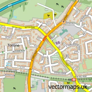
Nearby street map samples around Upholland

More street maps in Lancashire
750 metre map area coverage
Boundary, postcode and point of interest information for the 750m x 750m rectangle centred on this sample map.
Boundaries containing map centre
Constituency: West Lancashire Co Const
County: Lancashire County
District: West Lancashire District (B)
Icb: NHS Lancashire and South Cumbria ICB
Parish: Up Holland CP
Police Force: lancashire
Postcode District: WN8
Postcode Sector: WN8 0
Ward: Up Holland Ward
Nearby boundaries intersecting sample
Constituency: Makerfield Boro Const
District: Wigan District (B)
Icb: NHS Greater Manchester ICB
Police Force: greater manchester
Postcode District: WN5
Postcode Sector: WN5 8
Ward: Orrell Ward
Postcode coverage
POI category counts
Automotive Repair: 3
Pub: 3
Dentist: 2
Doctor: 2
Event Planning: 2
General Dentistry: 2
Optometrist: 2
Active Life: 1
Advertising Agency: 1
Assisted Living Facility: 1
Sample points of interest
- Signature School of Dance
- Orange Box Design
- Alma Green Residential Care Home
- J W Gaskell Garage Services
- Unipart Car Care Centre
- Upholland Motors
- Wide Cross Service Station
- Rathbones Upholland Bakery
- Old Dog Barbershop
- The Victoria Aesthetics Beauty Room
- Dean Wood Golf Club
- Cabinet Masters North
Create a larger editable map of Upholland
This sample shows only a 750 metre area. To create a larger map of Upholland, use our map builder to choose your own coverage area, add titles and download editable SVG, PDF and PNG files.
Create a custom map of Upholland