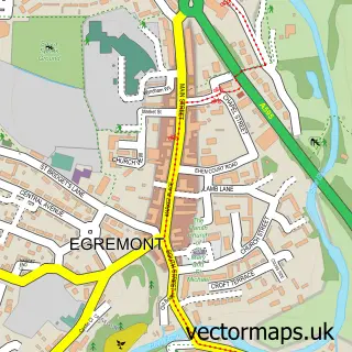
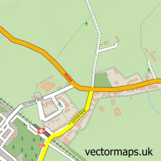
This Gosforth street map is a detailed vector street map covering a 750m x 750m area. Select a larger area to create and download your own vector street map of Gosforth.
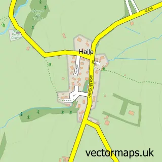
The 750-metre map sample for Gosforth covers 206 mapped buildings and approximately 13.0 km of road detail, of which 8 named roads are named. The immediate area includes 1 pub and 1 MOT station. The wider area around Gosforth features 1 tourism point of interest, 2 food and drink venues and 1 hotel. To create a larger or custom map of Gosforth, the map builder lets you define your own coverage area and download editable SVG, PDF and PNG files.
Create a larger editable map of Gosforth
Choose any area you need and generate a high-quality vector map instantly. Perfect for print, planning, design, business and personal use.

This Gosforth street map in Cumbria is available as downloadable SVG, PDF and PNG map files, or as a printed map for planning, business, display, education, local information and design work. You can also create a larger custom map area using the map selector.
What this Gosforth map sample shows
Gosforth lies within Gosforth Cp parish, part of Gosforth & Seascale ward in the Cumberland local authority area. The postcode geography for this area includes the CA postcode area, the CA20 postcode district and the CA20 1 postcode sector. Residents fall under the Nhs North East And North Cumbria Integrated Care Board for NHS services.
Local features near Gosforth
Within 2 milesAmenities and services in and around Gosforth.
Administrative and postcode information for Gosforth
The local authority covering Gosforth is Cumberland, within the county of Cumbria. The settlement lies within Gosforth & Seascale ward and Gosforth Cp civil parish. The CA20 postcode district and CA20 1 postcode sector serve the immediate area. NHS provision in the area is delivered through North Cumbria Integrated Care Nhs Foundation Trust.
Nearby street map samples around Gosforth

More street maps in Cumbria
750 metre map area coverage
Boundary, postcode and point of interest information for the 750m x 750m rectangle centred on this sample map.
Boundaries containing map centre
Constituency: Whitehaven and Workington Co Const
District: Cumberland
Icb: NHS North East and North Cumbria ICB
Parish: Gosforth CP
Police Force: cumbria
Postcode District: CA20
Postcode Sector: CA20 1
Ward: Gosforth Ward
Nearby boundaries intersecting sample
No additional intersecting boundaries found.
Postcode coverage
POI category counts
Convenience Store: 3
Accommodation: 1
Advertising Agency: 1
Arts And Entertainment: 1
Auto Company: 1
Automotive Repair: 1
Bakery: 1
Banks: 1
Bar: 1
Beauty Salon: 1
Sample points of interest
- Westlakes Hotel
- DWB Designs
- Gosforth
- JSK mechanical services LTD
- Beck Place Services
- Gosforth Bakery
- HSBC Bank
- Wheatsheaf Inn
- The Vanity Case Beauty Salon
- The Globe Hotel
- Marra Bikes and Boards
- The Lion and The Lamb, Gosforth
Create a larger editable map of Gosforth
This sample shows only a 750 metre area. To create a larger map of Gosforth, use our map builder to choose your own coverage area, add titles and download editable SVG, PDF and PNG files.
Create a custom map of Gosforth