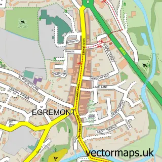
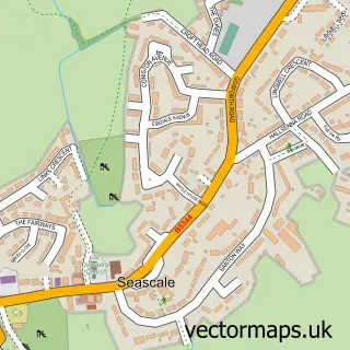
This Beckermet street map is a detailed vector street map covering a 750m x 750m area. Select a larger area to create and download your own vector street map of Beckermet.
The 750-metre map sample for Beckermet covers 246 mapped buildings and approximately 12.6 km of road detail, of which 12 named roads are named. The immediate area includes 1 school. The wider area around Beckermet features 2 hotels. To create a larger or custom map of Beckermet, the map builder lets you define your own coverage area and download editable SVG, PDF and PNG files.
Create a larger editable map of Beckermet
Choose any area you need and generate a high-quality vector map instantly. Perfect for print, planning, design, business and personal use.

This Beckermet street map in Cumbria is available as downloadable SVG, PDF and PNG map files, or as a printed map for planning, business, display, education, local information and design work. You can also create a larger custom map area using the map selector.
What this Beckermet map sample shows
Beckermet lies within Beckermet Cp parish, part of Beckermet ward in the Cumberland local authority area. The postcode geography for this area includes the CA postcode area, the CA21 postcode district and the CA21 2 postcode sector. Residents fall under the Nhs North East And North Cumbria Integrated Care Board for NHS services.
Local features near Beckermet
Within 2 milesAmenities and services in and around Beckermet.
Administrative and postcode information for Beckermet
The local authority covering Beckermet is Cumberland, within the county of Cumbria. The settlement lies within Beckermet ward and Beckermet Cp civil parish. The CA21 postcode district and CA21 2 postcode sector serve the immediate area. NHS provision in the area is delivered through North Cumbria Integrated Care Nhs Foundation Trust.
Nearby street map samples around Beckermet


More street maps in Cumbria
750 metre map area coverage
Boundary, postcode and point of interest information for the 750m x 750m rectangle centred on this sample map.
Boundaries containing map centre
Constituency: Whitehaven and Workington Co Const
District: Cumberland
Icb: NHS North East and North Cumbria ICB
Parish: Beckermet CP
Police Force: cumbria
Postcode District: CA21
Postcode Sector: CA21 2
Ward: Gosforth Ward
Nearby boundaries intersecting sample
No additional intersecting boundaries found.
Postcode coverage
POI category counts
Church Cathedral: 2
Hotel: 2
Train Station: 2
Anglican Church: 1
Beverage Supplier: 1
Business Advertising: 1
Copywriting Service: 1
Home Developer: 1
Preschool: 1
Spas: 1
Sample points of interest
- St John Beckermet
- Royal Oak Inn
- Meilleur Pack Pour Vous
- St Bridgets Low Church
- St John's Church
- Professional Essay Writers
- Hopesdale House
- Coney Garth Cottages - Cumbria
- The White Mare
- Beckermet Nursery
- Revive Holistic Massage
- Beckermet railway station
Create a larger editable map of Beckermet
This sample shows only a 750 metre area. To create a larger map of Beckermet, use our map builder to choose your own coverage area, add titles and download editable SVG, PDF and PNG files.
Create a custom map of Beckermet