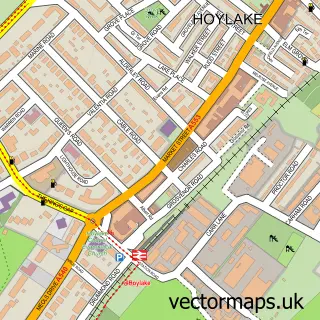
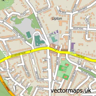
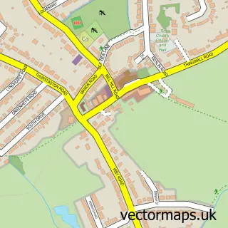
This Great Meols street map is a detailed vector street map covering a 750m x 750m area. Select a larger area to create and download your own vector street map of Great Meols.
The 750-metre map sample for Great Meols covers 349 mapped buildings and approximately 11.5 km of road detail, of which 23 named roads are named. The immediate area includes 1 school, 1 railway station, 1 GP surgery, with 4 within 2 miles and 1 pub among other local services. The wider area around Great Meols features 2 food and drink venues. To create a larger or custom map of Great Meols, the map builder lets you define your own coverage area and download editable SVG, PDF and PNG files.
Create a larger editable map of Great Meols
Choose any area you need and generate a high-quality vector map instantly. Perfect for print, planning, design, business and personal use.

This Great Meols street map in Merseyside is available as downloadable SVG, PDF and PNG map files, or as a printed map for planning, business, display, education, local information and design work. You can also create a larger custom map area using the map selector.
What this Great Meols map sample shows
Great Meols lies within Wirral District (B) parish, part of Hoylake And Meols ward in the Wirral District (B) local authority area. The postcode geography for this area includes the CH postcode area, the CH47 postcode district and the CH47 2 postcode sector. Residents fall under the Nhs Cheshire And Merseyside Integrated Care Board for NHS services.
Local features near Great Meols
Within 2 milesAmenities and services in and around Great Meols.
Administrative and postcode information for Great Meols
Great Meols lies within Wirral District (B) parish, part of Hoylake And Meols ward in the Wirral District (B) local authority area. The postcode geography for this area includes the CH postcode area, the CH47 postcode district and the CH47 2 postcode sector. Residents fall under the Nhs Cheshire And Merseyside Integrated Care Board for NHS services.
Nearby street map samples around Great Meols

More street maps in Merseyside
750 metre map area coverage
Boundary, postcode and point of interest information for the 750m x 750m rectangle centred on this sample map.
Boundaries containing map centre
Constituency: Wirral West Co Const
District: Wirral District (B)
Icb: NHS Cheshire and Merseyside ICB
Police Force: merseyside
Postcode District: CH47
Postcode Sector: CH47 8
Ward: Hoylake and Meols Ward
Nearby boundaries intersecting sample
Postcode Sector: CH47 0, CH47 6, CH47 7, CH47 9
Postcode coverage
POI category counts
Doctor: 4
Train Station: 2
Barber: 1
Beauty Salon: 1
Bed And Breakfast: 1
Building Supply Store: 1
Coffee Shop: 1
Construction Services: 1
Convenience Store: 1
Currency Exchange: 1
Sample points of interest
- The Barber Shop Meols
- Polished Nails & Beauty by Alex Johnstone
- Wyngate Guest House
- Island Electrical Engineering Limited
- Heima Coffee
- Spiral Interior Systems Ltd
- Morrisons Daily
- Post Office Travel Money
- Pegasus Disco
- Hoylake & Meols Medical Ctr
- Hoylake &meols Medical Centre
- Hoylake and Meols Medical Centre
Create a larger editable map of Great Meols
This sample shows only a 750 metre area. To create a larger map of Great Meols, use our map builder to choose your own coverage area, add titles and download editable SVG, PDF and PNG files.
Create a custom map of Great Meols