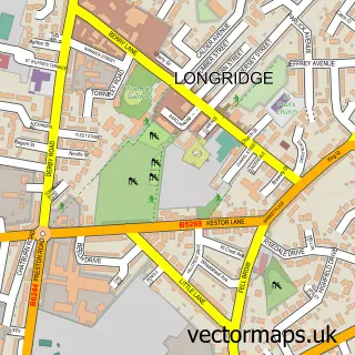
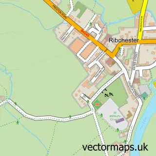
This Grimsargh street map is a detailed vector street map covering a 750m x 750m area. Select a larger area to create and download your own vector street map of Grimsargh.
The 750-metre map sample for Grimsargh covers 416 mapped buildings and approximately 13.4 km of road detail, of which 29 named roads are named. The immediate area includes 1 GP surgery within 2 miles, 1 pub and 1 MOT station, with 8 within 2 miles. The wider area around Grimsargh features 2 food and drink venues. To create a larger or custom map of Grimsargh, the map builder lets you define your own coverage area and download editable SVG, PDF and PNG files.
Create a larger editable map of Grimsargh
Choose any area you need and generate a high-quality vector map instantly. Perfect for print, planning, design, business and personal use.

This Grimsargh street map in Lancashire is available as downloadable SVG, PDF and PNG map files, or as a printed map for planning, business, display, education, local information and design work. You can also create a larger custom map area using the map selector.
What this Grimsargh map sample shows
Grimsargh lies within Grimsargh Cp parish, part of Preston Rural East ward in the Preston District (B) local authority area. The postcode geography for this area includes the PR postcode area, the PR2 postcode district and the PR2 5 postcode sector. Residents fall under the Nhs Lancashire And South Cumbria Integrated Care Board for NHS services.
Local features near Grimsargh
Within 2 milesAmenities and services in and around Grimsargh.
Administrative and postcode information for Grimsargh
The local authority covering Grimsargh is Preston District (B), within the county of Lancashire. The settlement lies within Preston Rural East ward and Grimsargh Cp civil parish. The PR2 postcode district and PR2 5 postcode sector serve the immediate area. NHS provision in the area is delivered through Lancashire Teaching Hospitals Nhs Foundation Trust.
Nearby street map samples around Grimsargh


More street maps in Lancashire
750 metre map area coverage
Boundary, postcode and point of interest information for the 750m x 750m rectangle centred on this sample map.
Boundaries containing map centre
Constituency: Ribble Valley Co Const
County: Lancashire County
District: Preston District (B)
Icb: NHS Lancashire and South Cumbria ICB
Parish: Grimsargh CP
Police Force: lancashire
Postcode District: PR2
Postcode Sector: PR2 5
Ward: Preston Rural East Ward
Nearby boundaries intersecting sample
No additional intersecting boundaries found.
Postcode coverage
POI category counts
Beauty Salon: 5
Day Care Preschool: 2
Gardener: 2
Pharmacy: 2
Physical Therapy: 2
Acupuncture: 1
Automotive: 1
Bridal Shop: 1
Car Dealer: 1
Church Cathedral: 1
Sample points of interest
- Charlotte Green Acupuncture
- Browns Mitsubishi
- Coladas
- Jodie Turner Nails and Beauty Room
- Karma Beauty
- Kersey Hair and Beauty Rooms
- LW Clinic
- Feathers and Florence
- Browns Mitsubishi
- Grimsargh St Michael's Church, C of E, Anglican
- Gaia Coffee Bar
- Grimsargh Village Hall
Create a larger editable map of Grimsargh
This sample shows only a 750 metre area. To create a larger map of Grimsargh, use our map builder to choose your own coverage area, add titles and download editable SVG, PDF and PNG files.
Create a custom map of Grimsargh