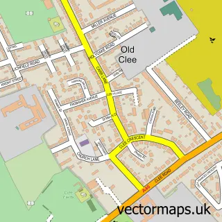
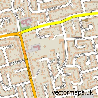
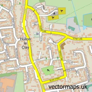
This Grimsby street map is a detailed vector street map covering a 750m x 750m area. Select a larger area to create and download your own vector street map of Grimsby.
The 750-metre map sample for Grimsby covers 187 mapped buildings and approximately 19.2 km of road detail, of which 46 named roads are named. The immediate area includes 1 school, 15 GP surgeries within 2 miles, 10 pubs and 3 MOT stations, with 33 within 2 miles. The wider area around Grimsby features 7 tourism points of interest and 22 food and drink venues. To create a larger or custom map of Grimsby, the map builder lets you define your own coverage area and download editable SVG, PDF and PNG files.
Create a larger editable map of Grimsby
Choose any area you need and generate a high-quality vector map instantly. Perfect for print, planning, design, business and personal use.

This Grimsby street map in Lincolnshire is available as downloadable SVG, PDF and PNG map files, or as a printed map for planning, business, display, education, local information and design work. You can also create a larger custom map area using the map selector.
What this Grimsby map sample shows
Grimsby lies within North East Lincolnshire (B) parish, part of East Marsh ward in the North East Lincolnshire (B) local authority area. The postcode geography for this area includes the DN postcode area, the DN31 postcode district and the DN31 3 postcode sector. Residents fall under the Nhs Humber And North Yorkshire Integrated Care Board for NHS services.
Local features near Grimsby
Within 2 milesAmenities and services in and around Grimsby.
Administrative and postcode information for Grimsby
The local authority covering Grimsby is North East Lincolnshire (B), within the county of Lincolnshire. The settlement lies within East Marsh ward and North East Lincolnshire (B) civil parish. The DN31 postcode district and DN31 3 postcode sector serve the immediate area. NHS provision in the area is delivered through Northern Lincolnshire And Goole Nhs Foundation Trust.
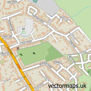
Nearby street map samples around Grimsby

More street maps in Lincolnshire
750 metre map area coverage
Boundary, postcode and point of interest information for the 750m x 750m rectangle centred on this sample map.
Boundaries containing map centre
Constituency: Great Grimsby and Cleethorpes Boro Const
District: North East Lincolnshire (B)
Icb: NHS Humber and North Yorkshire ICB
Police Force: humberside
Postcode District: DN32
Postcode Sector: DN32 9
Ward: East Marsh Ward
Nearby boundaries intersecting sample
Postcode District: DN31
Postcode Sector: DN31 1, DN32 0, DN32 7
Ward: Heneage Ward, Park Ward, West Marsh Ward
Postcode coverage
POI category counts
Beauty Salon: 18
Employment Agencies: 11
Furniture Store: 10
Professional Services: 10
Pub: 10
Barber: 9
Dentist: 9
Tattoo And Piercing: 9
Beauty And Spa: 8
Hair Salon: 8
Sample points of interest
- Creative Start CIC
- The Comeback
- Appleleaf Chartered Certified Accountants
- Linconshire Accountancy
- Best Training
- Fine & Country Northern Lincolnshire (Grimsby)
- Raven Gi
- Pleasure Island Cleethorpes
- Hainton Trading Co
- The Care Shop
- Electric Appliances
- Brighthouse
Create a larger editable map of Grimsby
This sample shows only a 750 metre area. To create a larger map of Grimsby, use our map builder to choose your own coverage area, add titles and download editable SVG, PDF and PNG files.
Create a custom map of Grimsby